Banyliv geodata
Banyliv (Chernivtsi Oblast') is a populated place; located in Ukraine in Europe/Kiev (GMT+3) time zone. With population of 3,748 people, there are 793 cities with bigger population in this country. Compared to other cities in Ukraine, 51.8% of cities are located further ↓South; 84.4% of cities are located further →East and 81.2% of cities have lower elevation than Banyliv. Note1


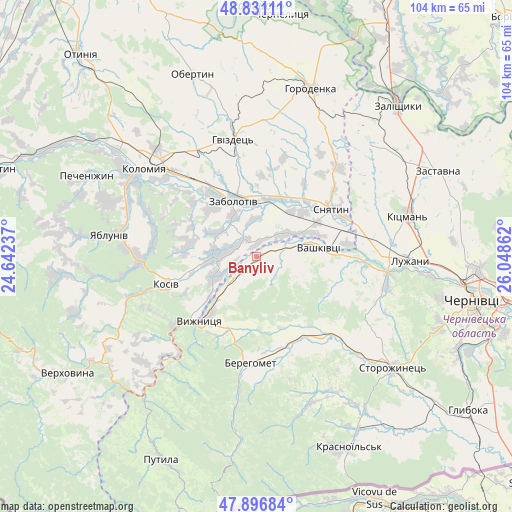
Banyliv GPS coordinates[2]
48° 21' 58.032" North, 25° 20' 43.764" East
| Map corner | latitude | longitude |
|---|---|---|
| Upper-left | 48.83111°, | 24.64237° |
| Center: | 48.36612°, | 25.34549° |
| Lower-right: | 47.89684°, | 26.04862° |
| Map W x H: | 103.9×103.9 km | = 64.6×64.6mi |
| max Lat: | 52.18903° ⇑48.2% North |
| Banyliv: | 48.36612° |
| min Lat: | ⇓51.8% South 44.39214° |
| min Long | Banyliv | max Long |
| 22.20555° | 25.34549° | 40.13222° |
| W 15.6%⇐ | ⇒84.4% E |
Elevation
Elevation of Banyliv is 253 m = 830 ft, and this is 97.2 m = 319 ft above average elevation for this country.
| Max E: |
886 m = 2907 ft | 18.8% |
| Banyliv | 253 m 830 ft | |
| Avg. | 155.8 m = 511 ft | |
Min E: |
-3 m = -10 ft | 81.2% |
See also: Ukraine elevation on elevation.city.
Geographical zone
Banyliv is located in North temperate zone (between Tropic of Cancer and the Arctic Circle). Distance of this North polar circle is 2023.4 km =1257.3 mi to North.| Distance of | km | miles | from Banyliv |
|---|---|---|---|
| North Pole | 4629.3 | 2876.5 | to North |
| Arctic Circle | 2023.4 | 1257.3 | to North |
| Tropic Cancer | 2771.9 | 1722.4 | to South |
| Equator | 5377.8 | 3341.6 | to South |


Nearby cities:
15 places around Banyliv: (largest is in red/bold)
• Berehomet
20.8 km =12.9 mi,  179°
179°
• Ispas
9.3 km =5.8 mi,  214°
214°
• Khymchyn
14.8 km =9.2 mi,  278°
278°
• Kolomyia
29.3 km =18.2 mi,  308°
308°
• Kosiv
19.5 km =12.1 mi,  251°
251°
• Kuty
17.1 km =10.6 mi,  225°
225°
• Myhove
23.3 km =14.5 mi,  173°
173°
• Rozhniv
8.8 km =5.5 mi,  269°
269°
• Sheshory
27 km =16.8 mi,  261°
261°
• Sniatyn
18.8 km =11.7 mi,  61°
61°
• Stari Kuty
16.6 km =10.3 mi, 230°
• Stetseva
24.7 km =15.3 mi,  43°
43°
• Vashkivtsi
12.3 km =7.6 mi,  80°
80°
• Vyzhnytsya
17.2 km =10.7 mi,  220°
220°
• Zabolotiv
12.4 km =7.7 mi,  339°
339°
Sources, notices
• [Note1] Compared only with cities in Ukraine existing in our database
• [Src1] Map data: © OpenStreetMap contributors (CC-BY-SA)
• [Src2] Other city data from geonames.org with taken over terms of usage.
• [Src3] Geographical zone / Annual Mean Temperature by Robert A. Rohde @ Wikipedia
