Tomakivka geodata
Tomakivka (Dnipropetrovsk) is a seat of a second-order administrative division; located in Ukraine in Europe/Kiev (GMT+3) time zone. With population of 8,006 people, there are 445 cities with bigger population in this country. Compared to other cities in Ukraine, 58.5% of cities are located further ↑North; 77.1% of cities are located further ←West and 78.4% of cities have higher elevation than Tomakivka. Note1


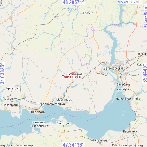
Tomakivka GPS coordinates[2]
47° 48' 56.484" North, 34° 44' 28.932" East
| Map corner | latitude | longitude |
|---|---|---|
| Upper-left | 48.28571°, | 34.03825° |
| Center: | 47.81569°, | 34.74137° |
| Lower-right: | 47.34138°, | 35.4445° |
| Map W x H: | 105×105 km | = 65.2×65.2mi |
| max Lat: | 52.18903° ⇑58.5% North |
| Tomakivka: | 47.81569° |
| min Lat: | ⇓41.5% South 44.39214° |
| min Long | Tomakivka | max Long |
| 22.20555° | 34.74137° | 40.13222° |
| W 77.1%⇐ | ⇒22.9% E |
Elevation
Elevation of Tomakivka is 49 m = 161 ft, and this is 106.8 m = 350 ft below average elevation for this country.
| Max E: |
886 m = 2907 ft | 78.4% |
| Avg. | 155.8 m = 511 ft | |
| Tomakivka | 49 m = 161 ft | |
Min E: |
-3 m = -10 ft | 21.6% |
See also: Ukraine elevation on elevation.city.
Geographical zone
Tomakivka is located in North temperate zone (between Tropic of Cancer and the Arctic Circle). Distance of this North polar circle is 2084.6 km =1295.3 mi to North.| Distance of | km | miles | from Tomakivka |
|---|---|---|---|
| North Pole | 4690.5 | 2914.5 | to North |
| Arctic Circle | 2084.6 | 1295.3 | to North |
| Tropic Cancer | 2710.7 | 1684.4 | to South |
| Equator | 5316.6 | 3303.6 | to South |


Nearby cities:
15 places around Tomakivka: (largest is in red/bold)
• Chervonohryhorivka
26.2 km =16.3 mi,  215°
215°
• Chortomlyk
49.7 km =30.9 mi,  244°
244°
• Dniprovka
43.9 km =27.3 mi,  192°
192°
• Energodar
35.8 km =22.2 mi, 190°
• Kamenka-Na-Dnepre
44.3 km =27.5 mi,  213°
213°
• Kushuhum
36.8 km =22.9 mi,  108°
108°
• Malokaterynivka
42.4 km =26.3 mi, 114°
• Marhanets’
21.8 km =13.5 mi,  202°
202°
• Nikopol
37.5 km =23.3 mi, 223°
• Novopokrovka
28.9 km =18 mi,  339°
339°
• Solone
44.7 km =27.8 mi,  12°
12°
• Vil’ne
20.7 km =12.9 mi,  164°
164°
• Vodyane
41 km =25.5 mi, 207°
• Vyshchetarasivka
29.4 km =18.3 mi, 159°
• Zaporizhia
33.5 km =20.8 mi,  88°
88°
Sources, notices
• [Note1] Compared only with cities in Ukraine existing in our database
• [Src1] Map data: © OpenStreetMap contributors (CC-BY-SA)
• [Src2] Other city data from geonames.org with taken over terms of usage.
• [Src3] Geographical zone / Annual Mean Temperature by Robert A. Rohde @ Wikipedia
