Zaporizhia geodata
Zaporizhia is a seat of a first-order administrative division; located in Ukraine in Europe/Zaporozhye (GMT+3) time zone. With population of 796,217 people, there are 5 cities with bigger population in this country. Compared to other cities in Ukraine, 58.4% of cities are located further ↑North; 82.3% of cities are located further ←West and 66.9% of cities have higher elevation than Zaporizhia. Note1


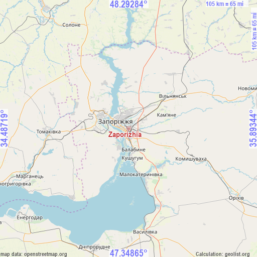
Zaporizhia GPS coordinates[2]
47° 49' 22.404" North, 35° 11' 25.116" East
| Map corner | latitude | longitude |
|---|---|---|
| Upper-left | 48.29284°, | 34.48719° |
| Center: | 47.82289°, | 35.19031° |
| Lower-right: | 47.34865°, | 35.89344° |
| Map W x H: | 105×105 km | = 65.2×65.2mi |
| max Lat: | 52.18903° ⇑58.4% North |
| Zaporizhia: | 47.82289° |
| min Lat: | ⇓41.6% South 44.39214° |
| min Long | Zaporizhia | max Long |
| 22.20555° | 35.19031° | 40.13222° |
| W 82.3%⇐ | ⇒17.7% E |
Elevation
Elevation of Zaporizhia is 84 m = 276 ft, and this is 71.8 m = 236 ft below average elevation for this country.
| Max E: |
886 m = 2907 ft | 66.9% |
| Avg. | 155.8 m = 511 ft | |
| Zaporizhia | 84 m = 276 ft | |
Min E: |
-3 m = -10 ft | 33.1% |
See also: Zaporizhia elevation on elevation.city.
Geographical zone
Zaporizhia is located in North temperate zone (between Tropic of Cancer and the Arctic Circle). Distance of this North polar circle is 2083.8 km =1294.8 mi to North.| Distance of | km | miles | from Zaporizhia |
|---|---|---|---|
| North Pole | 4689.7 | 2914 | to North |
| Arctic Circle | 2083.8 | 1294.8 | to North |
| Tropic Cancer | 2711.5 | 1684.8 | to South |
| Equator | 5317.4 | 3304.1 | to South |


Nearby cities:
15 places around Zaporizhia: (largest is in red/bold)
• Balky
52.2 km =32.4 mi,  200°
200°
• Dniprorudne
51.6 km =32.1 mi, 198°
• Kirove
42.2 km =26.2 mi,  116°
116°
• Komyshuvakha
28 km =17.4 mi, 115°
• Kushuhum
12.3 km =7.6 mi,  173°
173°
• Malokaterynivka
19.3 km =12 mi, 165°
• Marhanets’
47 km =29.2 mi,  243°
243°
• Novopokrovka
50.8 km =31.6 mi,  301°
301°
• Orikhiv
52.9 km =32.9 mi, 122°
• Solone
48.9 km =30.4 mi,  331°
331°
• Tomakivka
33.5 km =20.8 mi,  268°
268°
• Vasylivka
43.4 km =27 mi, 171°
• Vil’ne
35 km =21.7 mi,  233°
233°
• Vil’nyans’k
22.7 km =14.1 mi,  53°
53°
• Vyshchetarasivka
36.6 km =22.7 mi,  219°
219°
In other languages:
- In Spanish: Zaporiyia
- In France: Zaporijia
- In German: Saporischschja
- In Russian: Запорожье, Алекса́ндровск
- In Chinese: 扎波里日扎, 扎波罗热
Sources, notices
• [Note1] Compared only with cities in Ukraine existing in our database
• [Src1] Map data: © OpenStreetMap contributors (CC-BY-SA)
• [Src2] Other city data from geonames.org with taken over terms of usage.
• [Src3] Geographical zone / Annual Mean Temperature by Robert A. Rohde @ Wikipedia
