Kushuhum geodata
Kushuhum (Zaporizhia) is a populated place; located in Ukraine in Europe/Zaporozhye (GMT+3) time zone. With population of 7,475 people, there are 482 cities with bigger population in this country. Compared to other cities in Ukraine, 59.1% of cities are located further ↑North; 82.5% of cities are located further ←West and 77.2% of cities have higher elevation than Kushuhum. Note1


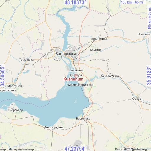
Kushuhum GPS coordinates[2]
47° 42' 46.008" North, 35° 12' 33.012" East
| Map corner | latitude | longitude |
|---|---|---|
| Upper-left | 48.18373°, | 34.50605° |
| Center: | 47.71278°, | 35.20917° |
| Lower-right: | 47.23754°, | 35.9123° |
| Map W x H: | 105.2×105.2 km | = 65.4×65.4mi |
| max Lat: | 52.18903° ⇑59.1% North |
| Kushuhum: | 47.71278° |
| min Lat: | ⇓40.9% South 44.39214° |
| min Long | Kushuhum | max Long |
| 22.20555° | 35.20917° | 40.13222° |
| W 82.5%⇐ | ⇒17.5% E |
Elevation
Elevation of Kushuhum is 53 m = 174 ft, and this is 102.8 m = 337 ft below average elevation for this country.
| Max E: |
886 m = 2907 ft | 77.2% |
| Avg. | 155.8 m = 511 ft | |
| Kushuhum | 53 m = 174 ft | |
Min E: |
-3 m = -10 ft | 22.8% |
See also: Ukraine elevation on elevation.city.
Geographical zone
Kushuhum is located in North temperate zone (between Tropic of Cancer and the Arctic Circle). Distance of this North polar circle is 2096 km =1302.4 mi to North.| Distance of | km | miles | from Kushuhum |
|---|---|---|---|
| North Pole | 4701.9 | 2921.6 | to North |
| Arctic Circle | 2096 | 1302.4 | to North |
| Tropic Cancer | 2699.2 | 1677.2 | to South |
| Equator | 5305.2 | 3296.5 | to South |


Nearby cities:
15 places around Kushuhum: (largest is in red/bold)
• Balky
41.7 km =25.9 mi,  208°
208°
• Dniprorudne
40.7 km =25.3 mi, 205°
• Energodar
47.7 km =29.6 mi,  240°
240°
• Kirove
37 km =23 mi,  100°
100°
• Komyshuvakha
24 km =14.9 mi,  89°
89°
• Malokaterynivka
7.3 km =4.5 mi,  150°
150°
• Marhanets’
44.4 km =27.6 mi,  258°
258°
• Orikhiv
46.1 km =28.6 mi,  110°
110°
• Preobrazhenka
48.1 km =29.9 mi, 108°
• Tomakivka
36.8 km =22.9 mi,  288°
288°
• Vasylivka
31.1 km =19.3 mi,  170°
170°
• Vil’ne
30.8 km =19.1 mi,  253°
253°
• Vil’nyans’k
30.7 km =19.1 mi,  33°
33°
• Vyshchetarasivka
29.4 km =18.3 mi, 236°
• Zaporizhia
12.3 km =7.6 mi,  353°
353°
Sources, notices
• [Note1] Compared only with cities in Ukraine existing in our database
• [Src1] Map data: © OpenStreetMap contributors (CC-BY-SA)
• [Src2] Other city data from geonames.org with taken over terms of usage.
• [Src3] Geographical zone / Annual Mean Temperature by Robert A. Rohde @ Wikipedia
