Stanytsya Luhans’ka geodata
Stanytsya Luhans’ka (Luhansk) is a seat of a second-order administrative division; located in Ukraine in Europe/Zaporozhye (GMT+3) time zone. With population of 12,765 people, there are 289 cities with bigger population in this country. Compared to other cities in Ukraine, 58.9% of cities are located further ↓South; 99.3% of cities are located further ←West and 79.5% of cities have higher elevation than Stanytsya Luhans’ka. Note1


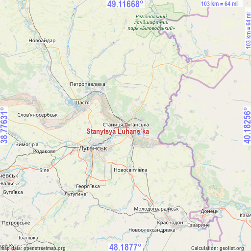
Stanytsya Luhans’ka GPS coordinates[2]
48° 39' 15.588" North, 39° 28' 45.948" East
| Map corner | latitude | longitude |
|---|---|---|
| Upper-left | 49.11668°, | 38.77631° |
| Center: | 48.65433°, | 39.47943° |
| Lower-right: | 48.1877°, | 40.18256° |
| Map W x H: | 103.3×103.3 km | = 64.2×64.2mi |
| max Lat: | 52.18903° ⇑41.1% North |
| Stanytsya Luhans’ka: | 48.65433° |
| min Lat: | ⇓58.9% South 44.39214° |
| min Long | Stanytsya Luhan | max Long |
| 22.20555° | 39.47943° | 40.13222° |
| W 99.3%⇐ | ⇒0.7% E |
Elevation
Elevation of Stanytsya Luhans’ka is 45 m = 148 ft, and this is 110.8 m = 364 ft below average elevation for this country.
| Max E: |
886 m = 2907 ft | 79.5% |
| Avg. | 155.8 m = 511 ft | |
| Stanytsya Luhans’ka | 45 m = 148 ft | |
Min E: |
-3 m = -10 ft | 20.5% |
See also: Ukraine elevation on elevation.city.
Geographical zone
Stanytsya Luhans’ka is located in North temperate zone (between Tropic of Cancer and the Arctic Circle). Distance of this North polar circle is 1991.3 km =1237.3 mi to North.| Distance of | km | miles | from Stanytsya Luhans’ka |
|---|---|---|---|
| North Pole | 4597.2 | 2856.6 | to North |
| Arctic Circle | 1991.3 | 1237.3 | to North |
| Tropic Cancer | 2803.9 | 1742.3 | to South |
| Equator | 5409.9 | 3361.6 | to South |


Nearby cities:
15 places around Stanytsya Luhans’ka: (largest is in red/bold)
• Bile
36.2 km =22.5 mi,  240°
240°
• Buran
40.6 km =25.2 mi,  165°
165°
• Lenina
35.1 km =21.8 mi,  224°
224°
• Luhansk
15.4 km =9.6 mi,  230°
230°
• Lutuhyne
33.4 km =20.8 mi,  213°
213°
• Makariv Yar
19.6 km =12.2 mi,  115°
115°
• Molodohvardiys’k
36.7 km =22.8 mi,  159°
159°
• Rozkishne
23.5 km =14.6 mi, 218°
• Shchastya
20.5 km =12.7 mi,  297°
297°
• Simeykyne
36.7 km =22.8 mi, 173°
• Slov`yanoserbsk
36.9 km =22.9 mi,  277°
277°
• Teple
38.5 km =23.9 mi, 170°
• Tr’okhizbenka
39.6 km =24.6 mi,  286°
286°
• Uspenka
37.4 km =23.2 mi, 218°
• Zymohiria
40.6 km =25.2 mi,  259°
259°
In other languages:
- In Russian: Luganskaya, Stanichno Luganskaya, Stanichnno-Luganskoye, Станица Луганская, Stanichno-Luganskoye
Sources, notices
• [Note1] Compared only with cities in Ukraine existing in our database
• [Src1] Map data: © OpenStreetMap contributors (CC-BY-SA)
• [Src2] Other city data from geonames.org with taken over terms of usage.
• [Src3] Geographical zone / Annual Mean Temperature by Robert A. Rohde @ Wikipedia
