Simeykyne geodata
Simeykyne (Luhansk) is a populated place; located in Ukraine in Europe/Zaporozhye (GMT+3) time zone. With population of 2,493 people, there are 1039 cities with bigger population in this country. Compared to other cities in Ukraine, 50.8% of cities are located further ↓South; 99.3% of cities are located further ←West and 68.2% of cities have lower elevation than Simeykyne. Note1


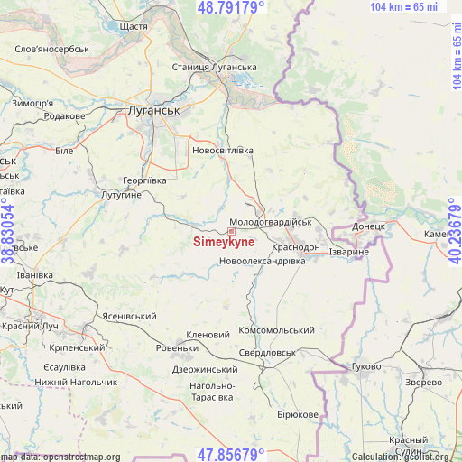
Simeykyne GPS coordinates[2]
48° 19' 35.148" North, 39° 32' 1.176" East
| Map corner | latitude | longitude |
|---|---|---|
| Upper-left | 48.79179°, | 38.83054° |
| Center: | 48.32643°, | 39.53366° |
| Lower-right: | 47.85679°, | 40.23679° |
| Map W x H: | 104×104 km | = 64.6×64.6mi |
| max Lat: | 52.18903° ⇑49.2% North |
| Simeykyne: | 48.32643° |
| min Lat: | ⇓50.8% South 44.39214° |
| min Long | Simeykyne | max Long |
| 22.20555° | 39.53366° | 40.13222° |
| W 99.3%⇐ | ⇒0.7% E |
Elevation
Elevation of Simeykyne is 199 m = 653 ft, and this is 43.2 m = 142 ft above average elevation for this country.
| Max E: |
886 m = 2907 ft | 31.8% |
| Simeykyne | 199 m 653 ft | |
| Avg. | 155.8 m = 511 ft | |
Min E: |
-3 m = -10 ft | 68.2% |
See also: Ukraine elevation on elevation.city.
Geographical zone
Simeykyne is located in North temperate zone (between Tropic of Cancer and the Arctic Circle). Distance of this North polar circle is 2027.8 km =1260 mi to North.| Distance of | km | miles | from Simeykyne |
|---|---|---|---|
| North Pole | 4633.7 | 2879.2 | to North |
| Arctic Circle | 2027.8 | 1260 | to North |
| Tropic Cancer | 2767.5 | 1719.6 | to South |
| Equator | 5373.4 | 3338.9 | to South |


Nearby cities:
15 places around Simeykyne: (largest is in red/bold)
• Buran
6.7 km =4.2 mi,  115°
115°
• Klenovyy
23.7 km =14.7 mi,  193°
193°
• Lenina
30.9 km =19.2 mi,  291°
291°
• Luhansk
31.2 km =19.4 mi,  329°
329°
• Lutuhyne
24.3 km =15.1 mi, 291°
• Makariv Yar
31.1 km =19.3 mi,  26°
26°
• Millerovo
32.4 km =20.1 mi,  237°
237°
• Molodohvardiys’k
9 km =5.6 mi,  76°
76°
• Roven’ky
29.4 km =18.3 mi,  203°
203°
• Rozkishne
26.1 km =16.2 mi,  313°
313°
• Sorokyne
15.7 km =9.8 mi,  103°
103°
• Sverdlovs’k
27.8 km =17.3 mi,  161°
161°
• Teple
2.7 km =1.7 mi,  125°
125°
• Uralo-Kavkaz
19.9 km =12.4 mi,  91°
91°
• Uspenka
28.3 km =17.6 mi,  284°
284°
Sources, notices
• [Note1] Compared only with cities in Ukraine existing in our database
• [Src1] Map data: © OpenStreetMap contributors (CC-BY-SA)
• [Src2] Other city data from geonames.org with taken over terms of usage.
• [Src3] Geographical zone / Annual Mean Temperature by Robert A. Rohde @ Wikipedia
