Makariv Yar geodata
Makariv Yar (Luhansk) is a populated place; located in Ukraine in Europe/Zaporozhye (GMT+3) time zone. With population of 1,470 people, there are 1219 cities with bigger population in this country. Compared to other cities in Ukraine, 57.4% of cities are located further ↓South; 99.7% of cities are located further ←West and 74.9% of cities have higher elevation than Makariv Yar. Note1


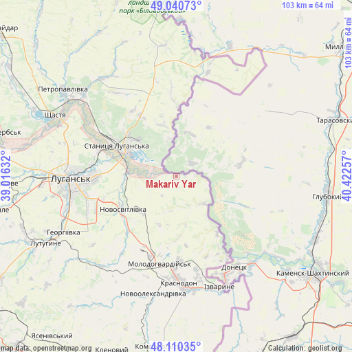
Makariv Yar GPS coordinates[2]
48° 34' 39.648" North, 39° 43' 9.984" East
| Map corner | latitude | longitude |
|---|---|---|
| Upper-left | 49.04073°, | 39.01632° |
| Center: | 48.57768°, | 39.71944° |
| Lower-right: | 48.11035°, | 40.42257° |
| Map W x H: | 103.4×103.4 km | = 64.2×64.2mi |
| max Lat: | 52.18903° ⇑42.6% North |
| Makariv Yar: | 48.57768° |
| min Lat: | ⇓57.4% South 44.39214° |
| min Long | Makariv Yar | max Long |
| 22.20555° | 39.71944° | 40.13222° |
| W 99.7%⇐ | ⇒0.3% E |
Elevation
Elevation of Makariv Yar is 61 m = 200 ft, and this is 94.8 m = 311 ft below average elevation for this country.
| Max E: |
886 m = 2907 ft | 74.9% |
| Avg. | 155.8 m = 511 ft | |
| Makariv Yar | 61 m = 200 ft | |
Min E: |
-3 m = -10 ft | 25.1% |
See also: Ukraine elevation on elevation.city.
Geographical zone
Makariv Yar is located in North temperate zone (between Tropic of Cancer and the Arctic Circle). Distance of this North polar circle is 1999.8 km =1242.6 mi to North.| Distance of | km | miles | from Makariv Yar |
|---|---|---|---|
| North Pole | 4605.7 | 2861.8 | to North |
| Arctic Circle | 1999.8 | 1242.6 | to North |
| Tropic Cancer | 2795.4 | 1737 | to South |
| Equator | 5401.3 | 3356.2 | to South |


Nearby cities:
15 places around Makariv Yar: (largest is in red/bold)
• Bile
50.1 km =31.1 mi,  259°
259°
• Buran
31.8 km =19.8 mi,  193°
193°
• Lenina
45.4 km =28.2 mi,  248°
248°
• Luhansk
29.6 km =18.4 mi,  267°
267°
• Lutuhyne
41.1 km =25.5 mi,  242°
242°
• Molodohvardiys’k
26.3 km =16.3 mi, 190°
• Rozkishne
33.9 km =21.1 mi, 253°
• Shchastya
40.1 km =24.9 mi,  296°
296°
• Simeykyne
31.1 km =19.3 mi,  206°
206°
• Sorokyne
31.8 km =19.8 mi,  177°
177°
• Stanytsya Luhans’ka
19.6 km =12.2 mi, 295°
• Sverdlovs’k
54.5 km =33.9 mi, 185°
• Teple
31.7 km =19.7 mi,  201°
201°
• Uralo-Kavkaz
29.2 km =18.1 mi,  167°
167°
• Uspenka
46 km =28.6 mi, 243°
Sources, notices
• [Note1] Compared only with cities in Ukraine existing in our database
• [Src1] Map data: © OpenStreetMap contributors (CC-BY-SA)
• [Src2] Other city data from geonames.org with taken over terms of usage.
• [Src3] Geographical zone / Annual Mean Temperature by Robert A. Rohde @ Wikipedia
