Serednye Vodyane geodata
Serednye Vodyane (Transcarpathia) is a populated place; located in Ukraine in Europe/Uzhgorod (GMT+3) time zone. With population of 5,465 people, there are 608 cities with bigger population in this country. Compared to other cities in Ukraine, 56.9% of cities are located further ↑North; 93.2% of cities are located further →East and 84.8% of cities have lower elevation than Serednye Vodyane. Note1


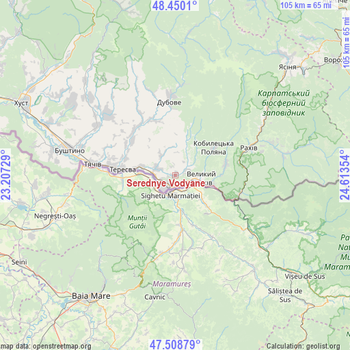
Serednye Vodyane GPS coordinates[2]
47° 58' 53.724" North, 23° 54' 37.476" East
| Map corner | latitude | longitude |
|---|---|---|
| Upper-left | 48.4501°, | 23.20729° |
| Center: | 47.98159°, | 23.91041° |
| Lower-right: | 47.50879°, | 24.61354° |
| Map W x H: | 104.7×104.7 km | = 65.1×65.1mi |
| max Lat: | 52.18903° ⇑56.9% North |
| Serednye Vodyane: | 47.98159° |
| min Lat: | ⇓43.1% South 44.39214° |
| min Long | Serednye Vodyan | max Long |
| 22.20555° | 23.91041° | 40.13222° |
| W 6.8%⇐ | ⇒93.2% E |
Elevation
Elevation of Serednye Vodyane is 272 m = 892 ft, and this is 116.2 m = 381 ft above average elevation for this country.
| Max E: |
886 m = 2907 ft | 15.2% |
| Serednye Vodyane | 272 m 892 ft | |
| Avg. | 155.8 m = 511 ft | |
Min E: |
-3 m = -10 ft | 84.8% |
See also: Ukraine elevation on elevation.city.
Geographical zone
Serednye Vodyane is located in North temperate zone (between Tropic of Cancer and the Arctic Circle). Distance of this North polar circle is 2066.1 km =1283.8 mi to North.| Distance of | km | miles | from Serednye Vodyane |
|---|---|---|---|
| North Pole | 4672 | 2903 | to North |
| Arctic Circle | 2066.1 | 1283.8 | to North |
| Tropic Cancer | 2729.1 | 1695.8 | to South |
| Equator | 5335.1 | 3315.1 | to South |


Nearby cities:
15 places around Serednye Vodyane: (largest is in red/bold)
• Bohdan
33.5 km =20.8 mi,  78°
78°
• Bushtyno
32.5 km =20.2 mi,  283°
283°
• Drahovo
39 km =24.2 mi,  316°
316°
• Dubove
21.2 km =13.2 mi,  355°
355°
• Kalyny
17.9 km =11.1 mi,  351°
351°
• Kopashnovo
41.2 km =25.6 mi,  309°
309°
• Kvasy
33.2 km =20.6 mi,  55°
55°
• Lazi
25.8 km =16 mi,  68°
68°
• Lopukhiv
42.8 km =26.6 mi,  5°
5°
• Neresnytsya
18.6 km =11.6 mi, 324°
• Nyzhnye Selyshche
42 km =26.1 mi, 305°
• Rakhiv
23 km =14.3 mi, 69°
• Solotvyno
5 km =3.1 mi,  217°
217°
• Tyachiv
25.5 km =15.8 mi, 277°
• Vyshkovo
37.2 km =23.1 mi, 281°
Sources, notices
• [Note1] Compared only with cities in Ukraine existing in our database
• [Src1] Map data: © OpenStreetMap contributors (CC-BY-SA)
• [Src2] Other city data from geonames.org with taken over terms of usage.
• [Src3] Geographical zone / Annual Mean Temperature by Robert A. Rohde @ Wikipedia
