Bohdan geodata
Bohdan (Transcarpathia) is a populated place; located in Ukraine in Europe/Uzhgorod (GMT+3) time zone. With population of 3,155 people, there are 899 cities with bigger population in this country. Compared to other cities in Ukraine, 56.1% of cities are located further ↑North; 90.4% of cities are located further →East and 98.6% of cities have lower elevation than Bohdan. Note1


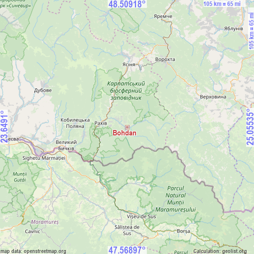
Bohdan GPS coordinates[2]
48° 2' 28.392" North, 24° 21' 7.992" East
| Map corner | latitude | longitude |
|---|---|---|
| Upper-left | 48.50918°, | 23.6491° |
| Center: | 48.04122°, | 24.35222° |
| Lower-right: | 47.56897°, | 25.05535° |
| Map W x H: | 104.5×104.5 km | = 64.9×64.9mi |
| max Lat: | 52.18903° ⇑56.1% North |
| Bohdan: | 48.04122° |
| min Lat: | ⇓43.9% South 44.39214° |
| min Long | Bohdan | max Long |
| 22.20555° | 24.35222° | 40.13222° |
| W 9.6%⇐ | ⇒90.4% E |
Elevation
Elevation of Bohdan is 542 m = 1778 ft, and this is 386.2 m = 1267 ft above average elevation for this country.
| Max E: |
886 m = 2907 ft | 1.4% |
| Bohdan | 542 m 1778 ft | |
| Avg. | 155.8 m = 511 ft | |
Min E: |
-3 m = -10 ft | 98.6% |
See also: Ukraine elevation on elevation.city.
Geographical zone
Bohdan is located in North temperate zone (between Tropic of Cancer and the Arctic Circle). Distance of this North polar circle is 2059.5 km =1279.7 mi to North.| Distance of | km | miles | from Bohdan |
|---|---|---|---|
| North Pole | 4665.4 | 2898.9 | to North |
| Arctic Circle | 2059.5 | 1279.7 | to North |
| Tropic Cancer | 2735.8 | 1699.9 | to South |
| Equator | 5341.7 | 3319.2 | to South |


Nearby cities:
15 places around Bohdan: (largest is in red/bold)
• Dubove
37.3 km =23.2 mi,  292°
292°
• Kalyny
37.2 km =23.1 mi, 287°
• Krivopol’ye
30.7 km =19.1 mi,  56°
56°
• Kvasy
13.2 km =8.2 mi,  336°
336°
• Lazeshchyna
25.8 km =16 mi,  11°
11°
• Lazi
9.3 km =5.8 mi, 287°
• Palyanytsya
34.9 km =21.7 mi, 10°
• Rakhiv
11.3 km =7 mi,  276°
276°
• Serednye Vodyane
33.5 km =20.8 mi,  258°
258°
• Solotvyno
37.4 km =23.2 mi,  253°
253°
• Tatariv
37.8 km =23.5 mi,  26°
26°
• Verkhovyna
35 km =21.7 mi,  68°
68°
• Vorokhta
31.3 km =19.4 mi, 30°
• Yablunytsya
32.2 km =20 mi,  17°
17°
• Yasinya
26.5 km =16.5 mi,  1°
1°
Sources, notices
• [Note1] Compared only with cities in Ukraine existing in our database
• [Src1] Map data: © OpenStreetMap contributors (CC-BY-SA)
• [Src2] Other city data from geonames.org with taken over terms of usage.
• [Src3] Geographical zone / Annual Mean Temperature by Robert A. Rohde @ Wikipedia
