Slavuta geodata
Slavuta (Khmelnytskyi) is a seat of a second-order administrative division; located in Ukraine in Europe/Kiev (GMT+3) time zone. With population of 33,080 people, there are 132 cities with bigger population in this country. Compared to other cities in Ukraine, 88% of cities are located further ↓South; 78.2% of cities are located further →East and 73.3% of cities have lower elevation than Slavuta. Note1


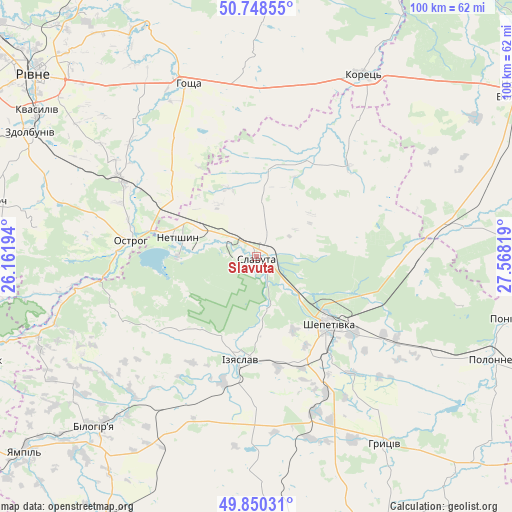
Slavuta GPS coordinates[2]
50° 18' 5.58" North, 26° 51' 54.216" East
| Map corner | latitude | longitude |
|---|---|---|
| Upper-left | 50.74855°, | 26.16194° |
| Center: | 50.30155°, | 26.86506° |
| Lower-right: | 49.85031°, | 27.56819° |
| Map W x H: | 99.9×99.9 km | = 62.1×62.1mi |
| max Lat: | 52.18903° ⇑12% North |
| Slavuta: | 50.30155° |
| min Lat: | ⇓88% South 44.39214° |
| min Long | Slavuta | max Long |
| 22.20555° | 26.86506° | 40.13222° |
| W 21.8%⇐ | ⇒78.2% E |
Elevation
Elevation of Slavuta is 218 m = 715 ft, and this is 62.2 m = 204 ft above average elevation for this country.
| Max E: |
886 m = 2907 ft | 26.7% |
| Slavuta | 218 m 715 ft | |
| Avg. | 155.8 m = 511 ft | |
Min E: |
-3 m = -10 ft | 73.3% |
See also: Ukraine elevation on elevation.city.
Geographical zone
Slavuta is located in North temperate zone (between Tropic of Cancer and the Arctic Circle). Distance of this North polar circle is 1808.2 km =1123.6 mi to North.| Distance of | km | miles | from Slavuta |
|---|---|---|---|
| North Pole | 4414.1 | 2742.8 | to North |
| Arctic Circle | 1808.2 | 1123.6 | to North |
| Tropic Cancer | 2987.1 | 1856.1 | to South |
| Equator | 5593 | 3475.3 | to South |


Nearby cities:
15 places around Slavuta: (largest is in red/bold)
• Horodyshche
51.6 km =32.1 mi,  316°
316°
• Hoshcha
35.9 km =22.3 mi,  337°
337°
• Izyaslav
20.5 km =12.7 mi,  188°
188°
• Kolodenka
50.1 km =31.1 mi,  309°
309°
• Korets
40.8 km =25.4 mi,  30°
30°
• Lyakhovtsy
45.5 km =28.3 mi,  223°
223°
• Mizoch
51.9 km =32.2 mi,  282°
282°
• Netishyn
16.4 km =10.2 mi,  285°
285°
• Ostroh
25.1 km =15.6 mi, 277°
• Polonne
50 km =31.1 mi,  113°
113°
• Poninka
49.5 km =30.8 mi, 105°
• Shepetivka
19.1 km =11.9 mi,  132°
132°
• Velyki Mezhyrichi
39.2 km =24.4 mi,  0°
0°
• Zdolbuniv
50.4 km =31.3 mi,  298°
298°
• Zdovbytsya
49.2 km =30.6 mi, 296°
Sources, notices
• [Note1] Compared only with cities in Ukraine existing in our database
• [Src1] Map data: © OpenStreetMap contributors (CC-BY-SA)
• [Src2] Other city data from geonames.org with taken over terms of usage.
• [Src3] Geographical zone / Annual Mean Temperature by Robert A. Rohde @ Wikipedia
