Shevchenkove geodata
Shevchenkove (Odesa) is a populated place; located in Ukraine in Europe/Kiev (GMT+3) time zone. With population of 5,362 people, there are 617 cities with bigger population in this country. Compared to other cities in Ukraine, 76% of cities are located further ↑North; 71% of cities are located further →East and 92.2% of cities have higher elevation than Shevchenkove. Note1


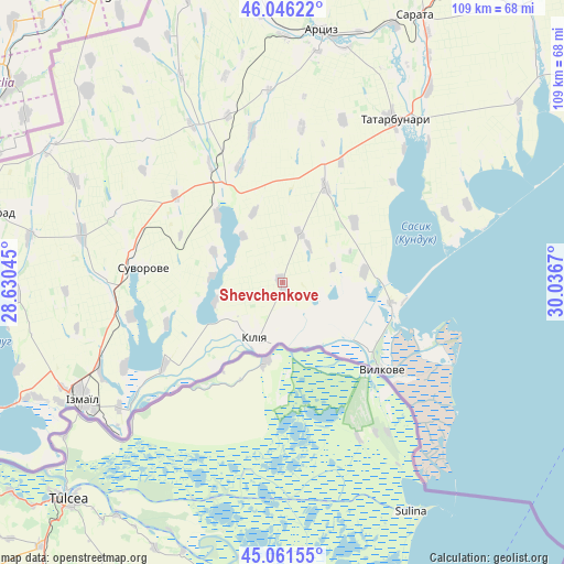
Shevchenkove GPS coordinates[2]
45° 33' 21.744" North, 29° 20' 0.852" East
| Map corner | latitude | longitude |
|---|---|---|
| Upper-left | 46.04622°, | 28.63045° |
| Center: | 45.55604°, | 29.33357° |
| Lower-right: | 45.06155°, | 30.0367° |
| Map W x H: | 109.5×109.5 km | = 68×68mi |
| max Lat: | 52.18903° ⇑76% North |
| Shevchenkove: | 45.55604° |
| min Lat: | ⇓24% South 44.39214° |
| min Long | Shevchenkove | max Long |
| 22.20555° | 29.33357° | 40.13222° |
| W 29%⇐ | ⇒71% E |
Elevation
Elevation of Shevchenkove is 16 m = 52 ft, and this is 139.8 m = 459 ft below average elevation for this country.
| Max E: |
886 m = 2907 ft | 92.2% |
| Avg. | 155.8 m = 511 ft | |
| Shevchenkove | 16 m = 52 ft | |
Min E: |
-3 m = -10 ft | 7.8% |
See also: Ukraine elevation on elevation.city.
Geographical zone
Shevchenkove is located in North temperate zone (between Tropic of Cancer and the Arctic Circle). Distance of this North polar circle is 2335.8 km =1451.4 mi to North.| Distance of | km | miles | from Shevchenkove |
|---|---|---|---|
| North Pole | 4941.7 | 3070.6 | to North |
| Arctic Circle | 2335.8 | 1451.4 | to North |
| Tropic Cancer | 2459.4 | 1528.2 | to South |
| Equator | 5065.4 | 3147.5 | to South |


Nearby cities:
15 places around Shevchenkove: (largest is in red/bold)
• Artsyz
48.9 km =30.4 mi,  7°
7°
• Bolhrad
57.6 km =35.8 mi,  284°
284°
• Broska
47.5 km =29.5 mi,  244°
244°
• Dmytrivka
53.5 km =33.2 mi,  329°
329°
• Horodnye
53 km =32.9 mi,  314°
314°
• Izmayil
44.8 km =27.8 mi, 239°
• Kalcheva
45.1 km =28 mi,  296°
296°
• Kiliya
12.5 km =7.8 mi,  205°
205°
• Novi Troyany
56.7 km =35.2 mi,  319°
319°
• Ozerne
54.1 km =33.6 mi,  251°
251°
• Sarata
57.6 km =35.8 mi,  26°
26°
• Tatarbunary
38.1 km =23.7 mi, 34°
• Vylkove
26.1 km =16.2 mi,  131°
131°
• Zaliznychne
59.8 km =37.2 mi,  290°
290°
• Zorya
55.9 km =34.7 mi, 30°
Sources, notices
• [Note1] Compared only with cities in Ukraine existing in our database
• [Src1] Map data: © OpenStreetMap contributors (CC-BY-SA)
• [Src2] Other city data from geonames.org with taken over terms of usage.
• [Src3] Geographical zone / Annual Mean Temperature by Robert A. Rohde @ Wikipedia
