Rykhtychi geodata
Rykhtychi (Lviv) is a populated place; located in Ukraine in Europe/Kiev (GMT+3) time zone. With population of 3,115 people, there are 907 cities with bigger population in this country. Compared to other cities in Ukraine, 72.4% of cities are located further ↓South; 95.2% of cities are located further →East and 87.8% of cities have lower elevation than Rykhtychi. Note1


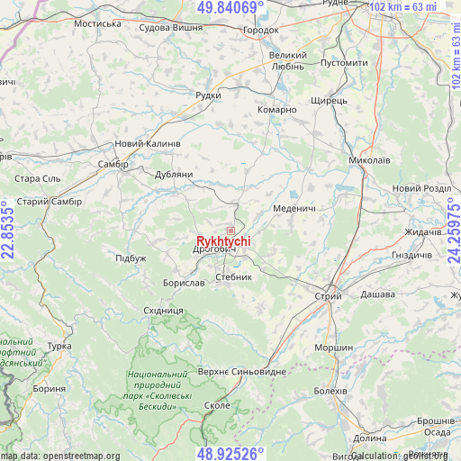
Rykhtychi GPS coordinates[2]
49° 23' 6.396" North, 23° 33' 23.832" East
| Map corner | latitude | longitude |
|---|---|---|
| Upper-left | 49.84069°, | 22.8535° |
| Center: | 49.38511°, | 23.55662° |
| Lower-right: | 48.92526°, | 24.25975° |
| Map W x H: | 101.8×101.8 km | = 63.3×63.3mi |
| max Lat: | 52.18903° ⇑27.6% North |
| Rykhtychi: | 49.38511° |
| min Lat: | ⇓72.4% South 44.39214° |
| min Long | Rykhtychi | max Long |
| 22.20555° | 23.55662° | 40.13222° |
| W 4.8%⇐ | ⇒95.2% E |
Elevation
Elevation of Rykhtychi is 293 m = 961 ft, and this is 137.2 m = 450 ft above average elevation for this country.
| Max E: |
886 m = 2907 ft | 12.2% |
| Rykhtychi | 293 m 961 ft | |
| Avg. | 155.8 m = 511 ft | |
Min E: |
-3 m = -10 ft | 87.8% |
See also: Ukraine elevation on elevation.city.
Geographical zone
Rykhtychi is located in North temperate zone (between Tropic of Cancer and the Arctic Circle). Distance of this North polar circle is 1910.1 km =1186.9 mi to North.| Distance of | km | miles | from Rykhtychi |
|---|---|---|---|
| North Pole | 4516 | 2806.1 | to North |
| Arctic Circle | 1910.1 | 1186.9 | to North |
| Tropic Cancer | 2885.2 | 1792.8 | to South |
| Equator | 5491.1 | 3412 | to South |


Nearby cities:
15 places around Rykhtychi: (largest is in red/bold)
• Boryslav
14.2 km =8.8 mi,  219°
219°
• Drohobych
5.4 km =3.4 mi, 223°
• Dublyany
17.6 km =10.9 mi,  315°
315°
• Duliby
25.4 km =15.8 mi,  132°
132°
• Komarno
28.8 km =17.9 mi,  20°
20°
• Medenychi
14.9 km =9.3 mi,  70°
70°
• Pidbuzh
23 km =14.3 mi,  255°
255°
• Ralivka
26.4 km =16.4 mi,  298°
298°
• Rudky
30.2 km =18.8 mi,  350°
350°
• Sambir
29.9 km =18.6 mi, 299°
• Skhidnytsya
23 km =14.3 mi, 220°
• Stebnyk
10.1 km =6.3 mi,  177°
177°
• Stryi
25.6 km =15.9 mi,  122°
122°
• Truskavets’
12.4 km =7.7 mi,  197°
197°
• Ulychne
18.2 km =11.3 mi,  157°
157°
Sources, notices
• [Note1] Compared only with cities in Ukraine existing in our database
• [Src1] Map data: © OpenStreetMap contributors (CC-BY-SA)
• [Src2] Other city data from geonames.org with taken over terms of usage.
• [Src3] Geographical zone / Annual Mean Temperature by Robert A. Rohde @ Wikipedia
