Rohatyn geodata
Rohatyn (Ivano-Frankivsk) is a seat of a second-order administrative division; located in Ukraine in Europe/Kiev (GMT+3) time zone. With population of 8,287 people, there are 426 cities with bigger population in this country. Compared to other cities in Ukraine, 72.9% of cities are located further ↓South; 88.8% of cities are located further →East and 81.5% of cities have lower elevation than Rohatyn. Note1


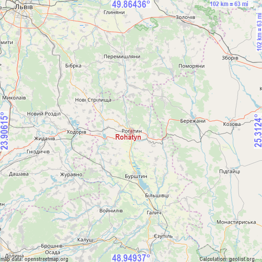
Rohatyn GPS coordinates[2]
49° 24' 32.4" North, 24° 36' 33.372" East
| Map corner | latitude | longitude |
|---|---|---|
| Upper-left | 49.86436°, | 23.90615° |
| Center: | 49.409°, | 24.60927° |
| Lower-right: | 48.94937°, | 25.3124° |
| Map W x H: | 101.7×101.7 km | = 63.2×63.2mi |
| max Lat: | 52.18903° ⇑27.1% North |
| Rohatyn: | 49.409° |
| min Lat: | ⇓72.9% South 44.39214° |
| min Long | Rohatyn | max Long |
| 22.20555° | 24.60927° | 40.13222° |
| W 11.2%⇐ | ⇒88.8% E |
Elevation
Elevation of Rohatyn is 255 m = 837 ft, and this is 99.2 m = 325 ft above average elevation for this country.
| Max E: |
886 m = 2907 ft | 18.5% |
| Rohatyn | 255 m 837 ft | |
| Avg. | 155.8 m = 511 ft | |
Min E: |
-3 m = -10 ft | 81.5% |
See also: Ukraine elevation on elevation.city.
Geographical zone
Rohatyn is located in North temperate zone (between Tropic of Cancer and the Arctic Circle). Distance of this North polar circle is 1907.4 km =1185.2 mi to North.| Distance of | km | miles | from Rohatyn |
|---|---|---|---|
| North Pole | 4513.3 | 2804.4 | to North |
| Arctic Circle | 1907.4 | 1185.2 | to North |
| Tropic Cancer | 2887.8 | 1794.4 | to South |
| Equator | 5493.8 | 3413.7 | to South |


Nearby cities:
15 places around Rohatyn: (largest is in red/bold)
• Bibrka
34.6 km =21.5 mi,  318°
318°
• Bilshivtsi
27.1 km =16.8 mi,  157°
157°
• Burshtyn
16.8 km =10.4 mi,  175°
175°
• Chesniki
8.8 km =5.5 mi,  105°
105°
• Dunayiv
27.9 km =17.3 mi,  33°
33°
• Halych
33 km =20.5 mi,  165°
165°
• Khodoriv
22 km =13.7 mi,  270°
270°
• Nadrichne
28.9 km =18 mi,  61°
61°
• Novi Strilyscha
19 km =11.8 mi,  308°
308°
• Peremyshlyany
28.7 km =17.8 mi,  352°
352°
• Ray
21.8 km =13.5 mi,  82°
82°
• Svirzh
29.3 km =18.2 mi,  335°
335°
• Vyshnivchyk
33.9 km =21.1 mi,  16°
16°
• Zhydachiv
33.9 km =21.1 mi, 265°
• Бережани
23.9 km =14.9 mi, 78°
Sources, notices
• [Note1] Compared only with cities in Ukraine existing in our database
• [Src1] Map data: © OpenStreetMap contributors (CC-BY-SA)
• [Src2] Other city data from geonames.org with taken over terms of usage.
• [Src3] Geographical zone / Annual Mean Temperature by Robert A. Rohde @ Wikipedia
