Goncharnoye geodata
Goncharnoye (Sevastopol City) is a populated place; located in Ukraine in Europe/Simferopol (GMT+3) time zone. With population of 591 people, there are 1591 cities with bigger population in this country. Compared to other cities in Ukraine, 99.4% of cities are located further ↑North; 55.5% of cities are located further ←West and 83% of cities have lower elevation than Goncharnoye. Note1
Administrative division(s):
- Level 1: Sevastopol City
- Level 2: Balaklava District
- Level 3: Orlinovskiy munitsipal'niy okrug


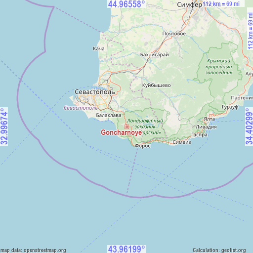
Goncharnoye GPS coordinates[2]
44° 27' 57.384" North, 33° 41' 59.496" East
| Map corner | latitude | longitude |
|---|---|---|
| Upper-left | 44.96558°, | 32.99674° |
| Center: | 44.46594°, | 33.69986° |
| Lower-right: | 43.96199°, | 34.40299° |
| Map W x H: | 111.6×111.6 km | = 69.3×69.3mi |
| max Lat: | 52.18903° ⇑99.4% North |
| Goncharnoye: | 44.46594° |
| min Lat: | ⇓0.6% South 44.39214° |
| min Long | Goncharnoye | max Long |
| 22.20555° | 33.69986° | 40.13222° |
| W 55.5%⇐ | ⇒44.5% E |
Elevation
Elevation of Goncharnoye is 263 m = 863 ft, and this is 107.2 m = 352 ft above average elevation for this country.
| Max E: |
886 m = 2907 ft | 17% |
| Goncharnoye | 263 m 863 ft | |
| Avg. | 155.8 m = 511 ft | |
Min E: |
-3 m = -10 ft | 83% |
See also: Ukraine elevation on elevation.city.
Geographical zone
Goncharnoye is located in North temperate zone (between Tropic of Cancer and the Arctic Circle). Distance of this Northern Tropic circle is 2338.2 km =1452.9 mi to South.| Distance of | km | miles | from Goncharnoye |
|---|---|---|---|
| North Pole | 5062.9 | 3145.9 | to North |
| Arctic Circle | 2457 | 1526.7 | to North |
| Tropic Cancer | 2338.2 | 1452.9 | to South |
| Equator | 4944.1 | 3072.1 | to South |


Nearby cities:
15 places around Goncharnoye: (largest is in red/bold)
• Balaklava
9.4 km =5.8 mi,  302°
302°
• Foros
10.8 km =6.7 mi,  139°
139°
• Inkerman
17.9 km =11.1 mi,  336°
336°
• Khmel’nitskoye
9.5 km =5.9 mi, 337°
• Orlinoye
6.4 km =4 mi,  109°
109°
• Peredovoye
11.3 km =7 mi,  64°
64°
• Pervomayskoye
10.4 km =6.5 mi,  321°
321°
• Rodnikovoye
12.1 km =7.5 mi,  90°
90°
• Rodnoye
10.3 km =6.4 mi,  17°
17°
• Sakharnaya Golovka
13.8 km =8.6 mi, 341°
• Shirokoye
5.7 km =3.5 mi,  74°
74°
• Shturmovoye
12.9 km =8 mi,  331°
331°
• Ternovka
13.2 km =8.2 mi, 17°
• Tylovoye
3.8 km =2.4 mi, 136°
• Zolotaya Balka (1 otd.)
11.2 km =7 mi,  311°
311°
Sources, notices
• [Note1] Compared only with cities in Ukraine existing in our database
• [Src1] Map data: © OpenStreetMap contributors (CC-BY-SA)
• [Src2] Other city data from geonames.org with taken over terms of usage.
• [Src3] Geographical zone / Annual Mean Temperature by Robert A. Rohde @ Wikipedia
