Pyatikhatka geodata
Pyatikhatka (Republic of Crimea) is a seat of a third-order administrative division; located in Ukraine in Europe/Simferopol (GMT+3) time zone. With population of 2,375 people, there are 1050 cities with bigger population in this country. Compared to other cities in Ukraine, 81.9% of cities are located further ↑North; 68.7% of cities are located further ←West and 74.9% of cities have higher elevation than Pyatikhatka. Note1
Administrative division(s):
- Level 1: Republic of Crimea
- Level 2: Krasnohvardiiske Raion
- Level 3: Pyatikhatskoye sel'skoye poselenye


Pyatikhatka GPS coordinates[2]
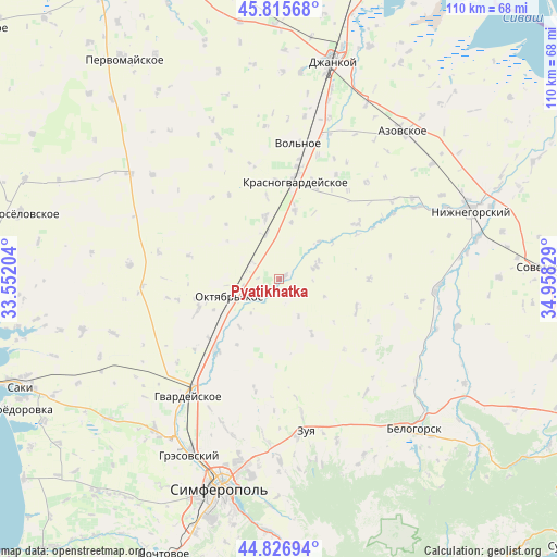
45° 19' 24.492" North, 34° 15' 18.576" East
| Map corner | latitude | longitude |
|---|---|---|
| Upper-left | 45.81568°, | 33.55204° |
| Center: | 45.32347°, | 34.25516° |
| Lower-right: | 44.82694°, | 34.95829° |
| Map W x H: | 109.9×109.9 km | = 68.3×68.3mi |
| max Lat: | 52.18903° ⇑81.9% North |
| Pyatikhatka: | 45.32347° |
| min Lat: | ⇓18.1% South 44.39214° |
| min Long | Pyatikhatka | max Long |
| 22.20555° | 34.25516° | 40.13222° |
| W 68.7%⇐ | ⇒31.3% E |
Elevation
Elevation of Pyatikhatka is 61 m = 200 ft, and this is 94.8 m = 311 ft below average elevation for this country.
| Max E: |
886 m = 2907 ft | 74.9% |
| Avg. | 155.8 m = 511 ft | |
| Pyatikhatka | 61 m = 200 ft | |
Min E: |
-3 m = -10 ft | 25.1% |
See also: Ukraine elevation on elevation.city.
Geographical zone
Pyatikhatka is located in North temperate zone (between Tropic of Cancer and the Arctic Circle). Distance of this North polar circle is 2361.7 km =1467.5 mi to North.| Distance of | km | miles | from Pyatikhatka |
|---|---|---|---|
| North Pole | 4967.6 | 3086.7 | to North |
| Arctic Circle | 2361.7 | 1467.5 | to North |
| Tropic Cancer | 2433.6 | 1512.2 | to South |
| Equator | 5039.5 | 3131.4 | to South |


Nearby cities:
15 places around Pyatikhatka: (largest is in red/bold)
• Amurskoye
11.1 km =6.9 mi,  243°
243°
• Dubrovskoye
12.7 km =7.9 mi,  306°
306°
• Kolodeznoye
12.5 km =7.8 mi,  149°
149°
• Komarovka
8.5 km =5.3 mi,  296°
296°
• Krasny Partizan
9.3 km =5.8 mi,  343°
343°
• Mar’yanovka
14 km =8.7 mi,  12°
12°
• Molochnoye
10.8 km =6.7 mi,  45°
45°
• Nekrasovo
11.5 km =7.1 mi, 11°
• Novoalekseyevka
11.7 km =7.3 mi,  252°
252°
• Novozuyevka
12.3 km =7.6 mi,  219°
219°
• Oktyabr’skoye
10.1 km =6.3 mi, 247°
• Poltavka
6.4 km =4 mi, 299°
• Rovnoye
8.2 km =5.1 mi,  67°
67°
• Udachnoye
7.6 km =4.7 mi,  16°
16°
• Yantarnoye
12.6 km =7.8 mi,  347°
347°
Sources, notices
• [Note1] Compared only with cities in Ukraine existing in our database
• [Src1] Map data: © OpenStreetMap contributors (CC-BY-SA)
• [Src2] Other city data from geonames.org with taken over terms of usage.
• [Src3] Geographical zone / Annual Mean Temperature by Robert A. Rohde @ Wikipedia
