Pryyutivka geodata
Pryyutivka (Kirovohrad) is a populated place; located in Ukraine in Europe/Kiev (GMT+3) time zone. With population of 3,238 people, there are 880 cities with bigger population in this country. Compared to other cities in Ukraine, 60.8% of cities are located further ↓South; 52.3% of cities are located further →East and 59.4% of cities have higher elevation than Pryyutivka. Note1


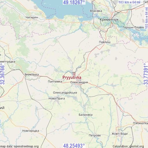
Pryyutivka GPS coordinates[2]
48° 43' 15.384" North, 33° 4' 14.808" East
| Map corner | latitude | longitude |
|---|---|---|
| Upper-left | 49.18267°, | 32.36766° |
| Center: | 48.72094°, | 33.07078° |
| Lower-right: | 48.25493°, | 33.77391° |
| Map W x H: | 103.2×103.2 km | = 64.1×64.1mi |
| max Lat: | 52.18903° ⇑39.2% North |
| Pryyutivka: | 48.72094° |
| min Lat: | ⇓60.8% South 44.39214° |
| min Long | Pryyutivka | max Long |
| 22.20555° | 33.07078° | 40.13222° |
| W 47.7%⇐ | ⇒52.3% E |
Elevation
Elevation of Pryyutivka is 107 m = 351 ft, and this is 48.8 m = 160 ft below average elevation for this country.
| Max E: |
886 m = 2907 ft | 59.4% |
| Avg. | 155.8 m = 511 ft | |
| Pryyutivka | 107 m = 351 ft | |
Min E: |
-3 m = -10 ft | 40.6% |
See also: Ukraine elevation on elevation.city.
Geographical zone
Pryyutivka is located in North temperate zone (between Tropic of Cancer and the Arctic Circle). Distance of this North polar circle is 1983.9 km =1232.7 mi to North.| Distance of | km | miles | from Pryyutivka |
|---|---|---|---|
| North Pole | 4589.8 | 2852 | to North |
| Arctic Circle | 1983.9 | 1232.7 | to North |
| Tropic Cancer | 2811.3 | 1746.9 | to South |
| Equator | 5417.3 | 3366.2 | to South |


Nearby cities:
15 places around Pryyutivka: (largest is in red/bold)
• Adzhamka
44.1 km =27.4 mi,  243°
243°
• Dmytrivka
27.3 km =17 mi,  288°
288°
• Kamennyye Potoki
44 km =27.3 mi,  49°
49°
• Kremenchuk
46.3 km =28.8 mi,  33°
33°
• Nova Praha
21 km =13 mi,  216°
216°
• Novyy Starodub
24 km =14.9 mi,  161°
161°
• Oleksandriya
6.6 km =4.1 mi,  149°
149°
• Oleksandriys’ke
14.1 km =8.8 mi,  206°
206°
• Onufriyivka
34.6 km =21.5 mi, 53°
• Pantayivka
14.7 km =9.1 mi,  249°
249°
• Pavlysh
30.3 km =18.8 mi,  43°
43°
• Petrove
46.1 km =28.6 mi, 162°
• Subottsi
41 km =25.5 mi,  259°
259°
• Svitlovods’k
38.5 km =23.9 mi,  18°
18°
• Znomenka
29.8 km =18.5 mi,  268°
268°
Sources, notices
• [Note1] Compared only with cities in Ukraine existing in our database
• [Src1] Map data: © OpenStreetMap contributors (CC-BY-SA)
• [Src2] Other city data from geonames.org with taken over terms of usage.
• [Src3] Geographical zone / Annual Mean Temperature by Robert A. Rohde @ Wikipedia
