Pryshyb geodata
Pryshyb (Zaporizhia) is a populated place; located in Ukraine in Europe/Zaporozhye (GMT+3) time zone. With population of 3,365 people, there are 854 cities with bigger population in this country. Compared to other cities in Ukraine, 62.3% of cities are located further ↑North; 83.4% of cities are located further ←West and 65.1% of cities have higher elevation than Pryshyb. Note1


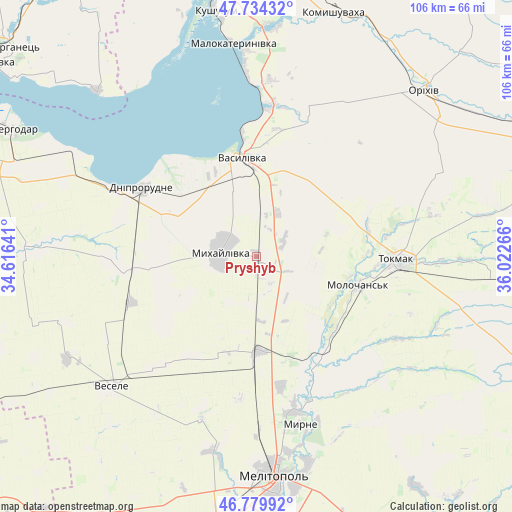
Pryshyb GPS coordinates[2]
47° 15' 33.372" North, 35° 19' 10.308" East
| Map corner | latitude | longitude |
|---|---|---|
| Upper-left | 47.73432°, | 34.61641° |
| Center: | 47.25927°, | 35.31953° |
| Lower-right: | 46.77992°, | 36.02266° |
| Map W x H: | 106.1×106.1 km | = 65.9×65.9mi |
| max Lat: | 52.18903° ⇑62.3% North |
| Pryshyb: | 47.25927° |
| min Lat: | ⇓37.7% South 44.39214° |
| min Long | Pryshyb | max Long |
| 22.20555° | 35.31953° | 40.13222° |
| W 83.4%⇐ | ⇒16.6% E |
Elevation
Elevation of Pryshyb is 90 m = 295 ft, and this is 65.8 m = 216 ft below average elevation for this country.
| Max E: |
886 m = 2907 ft | 65.1% |
| Avg. | 155.8 m = 511 ft | |
| Pryshyb | 90 m = 295 ft | |
Min E: |
-3 m = -10 ft | 34.9% |
See also: Ukraine elevation on elevation.city.
Geographical zone
Pryshyb is located in North temperate zone (between Tropic of Cancer and the Arctic Circle). Distance of this North polar circle is 2146.4 km =1333.7 mi to North.| Distance of | km | miles | from Pryshyb |
|---|---|---|---|
| North Pole | 4752.3 | 2952.9 | to North |
| Arctic Circle | 2146.4 | 1333.7 | to North |
| Tropic Cancer | 2648.8 | 1645.9 | to South |
| Equator | 5254.7 | 3265.1 | to South |


Nearby cities:
15 places around Pryshyb: (largest is in red/bold)
• Balky
31.5 km =19.6 mi,  295°
295°
• Dniprorudne
29.2 km =18.1 mi, 297°
• Mala Bilozerka
29.1 km =18.1 mi,  267°
267°
• Malokaterynivka
44.3 km =27.5 mi,  353°
353°
• Matviyivka
24.4 km =15.2 mi,  212°
212°
• Melitopol
45.8 km =28.5 mi,  175°
175°
• Mykhaylivka
7.5 km =4.7 mi,  281°
281°
• Novobohdanivka
19.4 km =12.1 mi, 177°
• Terpinnya
33.1 km =20.6 mi,  166°
166°
• Tokmak
29.6 km =18.4 mi,  90°
90°
• Tymoshivka
17.5 km =10.9 mi,  241°
241°
• Vasylivka
20 km =12.4 mi, 350°
• Velyka Bilozerka
46.3 km =28.8 mi, 272°
• Vesele
40.9 km =25.4 mi,  228°
228°
• Voznesenka
44.5 km =27.7 mi, 165°
Sources, notices
• [Note1] Compared only with cities in Ukraine existing in our database
• [Src1] Map data: © OpenStreetMap contributors (CC-BY-SA)
• [Src2] Other city data from geonames.org with taken over terms of usage.
• [Src3] Geographical zone / Annual Mean Temperature by Robert A. Rohde @ Wikipedia
