Vasylivka geodata
Vasylivka (Zaporizhia) is a seat of a second-order administrative division; located in Ukraine in Europe/Zaporozhye (GMT+3) time zone. With population of 15,012 people, there are 256 cities with bigger population in this country. Compared to other cities in Ukraine, 61.1% of cities are located further ↑North; 83.2% of cities are located further ←West and 81.3% of cities have higher elevation than Vasylivka. Note1


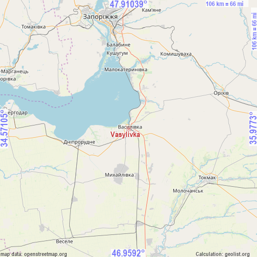
Vasylivka GPS coordinates[2]
47° 26' 12.984" North, 35° 16' 27.012" East
| Map corner | latitude | longitude |
|---|---|---|
| Upper-left | 47.91039°, | 34.57105° |
| Center: | 47.43694°, | 35.27417° |
| Lower-right: | 46.9592°, | 35.9773° |
| Map W x H: | 105.8×105.8 km | = 65.7×65.7mi |
| max Lat: | 52.18903° ⇑61.1% North |
| Vasylivka: | 47.43694° |
| min Lat: | ⇓38.9% South 44.39214° |
| min Long | Vasylivka | max Long |
| 22.20555° | 35.27417° | 40.13222° |
| W 83.2%⇐ | ⇒16.8% E |
Elevation
Elevation of Vasylivka is 39 m = 128 ft, and this is 116.8 m = 383 ft below average elevation for this country.
| Max E: |
886 m = 2907 ft | 81.3% |
| Avg. | 155.8 m = 511 ft | |
| Vasylivka | 39 m = 128 ft | |
Min E: |
-3 m = -10 ft | 18.7% |
See also: Ukraine elevation on elevation.city.
Geographical zone
Vasylivka is located in North temperate zone (between Tropic of Cancer and the Arctic Circle). Distance of this North polar circle is 2126.7 km =1321.5 mi to North.| Distance of | km | miles | from Vasylivka |
|---|---|---|---|
| North Pole | 4732.6 | 2940.7 | to North |
| Arctic Circle | 2126.7 | 1321.5 | to North |
| Tropic Cancer | 2668.6 | 1658.2 | to South |
| Equator | 5274.5 | 3277.4 | to South |


Nearby cities:
15 places around Vasylivka: (largest is in red/bold)
• Balky
25.6 km =15.9 mi,  256°
256°
• Dniprorudne
23.2 km =14.4 mi,  254°
254°
• Kirove
39.7 km =24.7 mi,  52°
52°
• Komyshuvakha
36.5 km =22.7 mi,  31°
31°
• Kushuhum
31.1 km =19.3 mi,  350°
350°
• Mala Bilozerka
33.2 km =20.6 mi,  230°
230°
• Malokaterynivka
24.3 km =15.1 mi,  356°
356°
• Mykhaylivka
18.7 km =11.6 mi,  192°
192°
• Novobohdanivka
39.3 km =24.4 mi,  173°
173°
• Orikhiv
41.1 km =25.5 mi,  69°
69°
• Pryshyb
20 km =12.4 mi, 170°
• Tokmak
38.7 km =24 mi,  121°
121°
• Tymoshivka
30.5 km =19 mi,  202°
202°
• Vil’ne
41.1 km =25.5 mi,  302°
302°
• Vyshchetarasivka
33 km =20.5 mi, 296°
In other languages:
- In France: Vassylivka
- In German: Wassyliwka
- In Russian: Василівка
- In Chinese: 瓦西利夫卡
Sources, notices
• [Note1] Compared only with cities in Ukraine existing in our database
• [Src1] Map data: © OpenStreetMap contributors (CC-BY-SA)
• [Src2] Other city data from geonames.org with taken over terms of usage.
• [Src3] Geographical zone / Annual Mean Temperature by Robert A. Rohde @ Wikipedia
