Ostrovskoye geodata
Ostrovskoye (Republic of Crimea) is a seat of a third-order administrative division; located in Ukraine in Europe/Simferopol (GMT+3) time zone. With population of 1,123 people, there are 1326 cities with bigger population in this country. Compared to other cities in Ukraine, 72.7% of cities are located further ↑North; 64.7% of cities are located further ←West and 90.9% of cities have higher elevation than Ostrovskoye. Note1
Administrative division(s):
- Level 1: Republic of Crimea
- Level 2: Pervomayskiy rayon
- Level 3: Ostrovskoye sel'skoye poselenye


Ostrovskoye GPS coordinates[2]
45° 44' 32.352" North, 34° 3' 57.852" East
| Map corner | latitude | longitude |
|---|---|---|
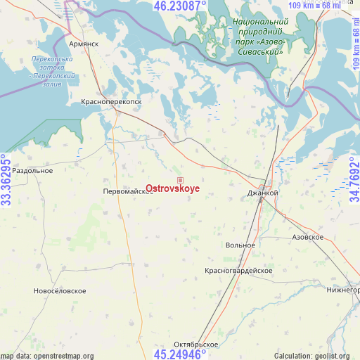
| Upper-left | 46.23087°, | 33.36295° |
| Center: | 45.74232°, | 34.06607° |
| Lower-right: | 45.24946°, | 34.7692° |
| Map W x H: | 109.1×109.1 km | = 67.8×67.8mi |
| max Lat: | 52.18903° ⇑72.7% North |
| Ostrovskoye: | 45.74232° |
| min Lat: | ⇓27.3% South 44.39214° |
| min Long | Ostrovskoye | max Long |
| 22.20555° | 34.06607° | 40.13222° |
| W 64.7%⇐ | ⇒35.3% E |
Elevation
Elevation of Ostrovskoye is 18 m = 59 ft, and this is 137.8 m = 452 ft below average elevation for this country.
| Max E: |
886 m = 2907 ft | 90.9% |
| Avg. | 155.8 m = 511 ft | |
| Ostrovskoye | 18 m = 59 ft | |
Min E: |
-3 m = -10 ft | 9.1% |
See also: Ukraine elevation on elevation.city.
Geographical zone
Ostrovskoye is located in North temperate zone (between Tropic of Cancer and the Arctic Circle). Distance of this North polar circle is 2315.1 km =1438.5 mi to North.| Distance of | km | miles | from Ostrovskoye |
|---|---|---|---|
| North Pole | 4921 | 3057.8 | to North |
| Arctic Circle | 2315.1 | 1438.5 | to North |
| Tropic Cancer | 2480.2 | 1541.1 | to South |
| Equator | 5086.1 | 3160.4 | to South |


Nearby cities:
15 places around Ostrovskoye: (largest is in red/bold)
• Abrikosovo
6.2 km =3.9 mi,  153°
153°
• Bratskoye
15 km =9.3 mi,  311°
311°
• Krest’yanovka
10.1 km =6.3 mi,  257°
257°
• Krymka
10.3 km =6.4 mi,  113°
113°
• Lobanovo
14.2 km =8.8 mi,  74°
74°
• Luganskoye
14.9 km =9.3 mi,  63°
63°
• Magazinka
13.5 km =8.4 mi,  354°
354°
• Novoivanovka
11 km =6.8 mi, 350°
• Novokrymskoye
8.1 km =5 mi, 58°
• Oktyabr’skoye
13.3 km =8.3 mi,  223°
223°
• Orlovskoye
10.5 km =6.5 mi,  316°
316°
• Pakharevka
12.7 km =7.9 mi,  35°
35°
• Roskoshnoye
10.8 km =6.7 mi,  159°
159°
• Voinka
15.3 km =9.5 mi,  337°
337°
• Zernovoye
13.9 km =8.6 mi, 154°
Sources, notices
• [Note1] Compared only with cities in Ukraine existing in our database
• [Src1] Map data: © OpenStreetMap contributors (CC-BY-SA)
• [Src2] Other city data from geonames.org with taken over terms of usage.
• [Src3] Geographical zone / Annual Mean Temperature by Robert A. Rohde @ Wikipedia
