Mykolayivka geodata
Mykolayivka (Odesa) is a seat of a second-order administrative division; located in Ukraine in Europe/Kiev (GMT+3) time zone. With population of 3,629 people, there are 812 cities with bigger population in this country. Compared to other cities in Ukraine, 60.4% of cities are located further ↑North; 63.2% of cities are located further →East and 80.6% of cities have higher elevation than Mykolayivka. Note1


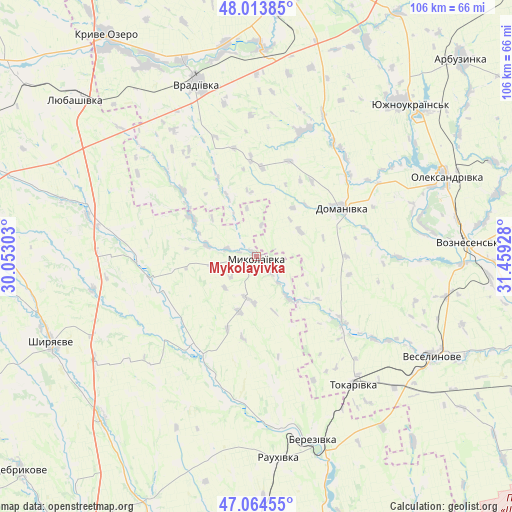
Mykolayivka GPS coordinates[2]
47° 32' 28.86" North, 30° 45' 22.14" East
| Map corner | latitude | longitude |
|---|---|---|
| Upper-left | 48.01385°, | 30.05303° |
| Center: | 47.54135°, | 30.75615° |
| Lower-right: | 47.06455°, | 31.45928° |
| Map W x H: | 105.6×105.6 km | = 65.6×65.6mi |
| max Lat: | 52.18903° ⇑60.4% North |
| Mykolayivka: | 47.54135° |
| min Lat: | ⇓39.6% South 44.39214° |
| min Long | Mykolayivka | max Long |
| 22.20555° | 30.75615° | 40.13222° |
| W 36.8%⇐ | ⇒63.2% E |
Elevation
Elevation of Mykolayivka is 41 m = 135 ft, and this is 114.8 m = 377 ft below average elevation for this country.
| Max E: |
886 m = 2907 ft | 80.6% |
| Avg. | 155.8 m = 511 ft | |
| Mykolayivka | 41 m = 135 ft | |
Min E: |
-3 m = -10 ft | 19.4% |
See also: Ukraine elevation on elevation.city.
Geographical zone
Mykolayivka is located in North temperate zone (between Tropic of Cancer and the Arctic Circle). Distance of this North polar circle is 2115.1 km =1314.3 mi to North.| Distance of | km | miles | from Mykolayivka |
|---|---|---|---|
| North Pole | 4721 | 2933.5 | to North |
| Arctic Circle | 2115.1 | 1314.3 | to North |
| Tropic Cancer | 2680.2 | 1665.4 | to South |
| Equator | 5286.1 | 3284.6 | to South |


Nearby cities:
15 places around Mykolayivka: (largest is in red/bold)
• Ananyiv Pershyi
64 km =39.8 mi,  288°
288°
• Arbuzynka
58.8 km =36.5 mi,  45°
45°
• Berezivka
39.2 km =24.4 mi,  163°
163°
• Domanivka
20.1 km =12.5 mi,  59°
59°
• Kostyantynivka
42.6 km =26.5 mi,  41°
41°
• Kryve Ozero
54.9 km =34.1 mi,  326°
326°
• Lyubashivka
49.6 km =30.8 mi,  311°
311°
• Myhiya
57 km =35.4 mi,  14°
14°
• Pervomays’k
56.4 km =35 mi, 7°
• Pidhorodna
63.7 km =39.6 mi, 8°
• Shyryayeve
45.7 km =28.4 mi,  246°
246°
• Veselynove
41.4 km =25.7 mi,  119°
119°
• Voznesensk
43.2 km =26.8 mi,  86°
86°
• Vradiyivka
37.7 km =23.4 mi,  340°
340°
• Yuzhnoukrains'k
44.3 km =27.5 mi, 46°
Sources, notices
• [Note1] Compared only with cities in Ukraine existing in our database
• [Src1] Map data: © OpenStreetMap contributors (CC-BY-SA)
• [Src2] Other city data from geonames.org with taken over terms of usage.
• [Src3] Geographical zone / Annual Mean Temperature by Robert A. Rohde @ Wikipedia
