Shyryayeve geodata
Shyryayeve (Odesa) is a seat of a second-order administrative division; located in Ukraine in Europe/Kiev (GMT+3) time zone. With population of 7,018 people, there are 507 cities with bigger population in this country. Compared to other cities in Ukraine, 61.6% of cities are located further ↑North; 66.8% of cities are located further →East and 76.7% of cities have higher elevation than Shyryayeve. Note1


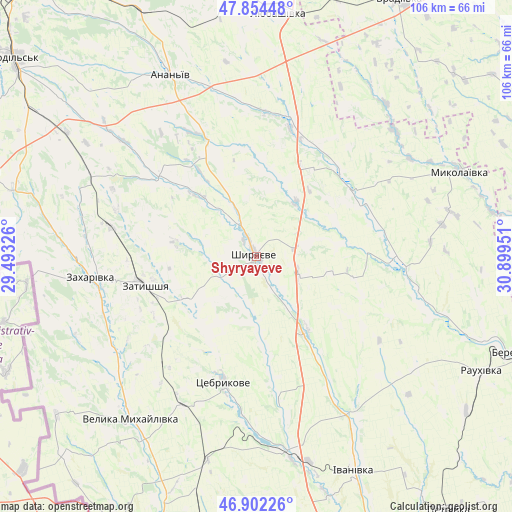
Shyryayeve GPS coordinates[2]
47° 22' 49.872" North, 30° 11' 46.968" East
| Map corner | latitude | longitude |
|---|---|---|
| Upper-left | 47.85448°, | 29.49326° |
| Center: | 47.38052°, | 30.19638° |
| Lower-right: | 46.90226°, | 30.89951° |
| Map W x H: | 105.9×105.9 km | = 65.8×65.8mi |
| max Lat: | 52.18903° ⇑61.6% North |
| Shyryayeve: | 47.38052° |
| min Lat: | ⇓38.4% South 44.39214° |
| min Long | Shyryayeve | max Long |
| 22.20555° | 30.19638° | 40.13222° |
| W 33.2%⇐ | ⇒66.8% E |
Elevation
Elevation of Shyryayeve is 54 m = 177 ft, and this is 101.8 m = 334 ft below average elevation for this country.
| Max E: |
886 m = 2907 ft | 76.7% |
| Avg. | 155.8 m = 511 ft | |
| Shyryayeve | 54 m = 177 ft | |
Min E: |
-3 m = -10 ft | 23.3% |
See also: Ukraine elevation on elevation.city.
Geographical zone
Shyryayeve is located in North temperate zone (between Tropic of Cancer and the Arctic Circle). Distance of this North polar circle is 2133 km =1325.4 mi to North.| Distance of | km | miles | from Shyryayeve |
|---|---|---|---|
| North Pole | 4738.8 | 2944.6 | to North |
| Arctic Circle | 2133 | 1325.4 | to North |
| Tropic Cancer | 2662.3 | 1654.3 | to South |
| Equator | 5268.2 | 3273.5 | to South |


Nearby cities:
15 places around Shyryayeve: (largest is in red/bold)
• Ananyiv Pershyi
42.3 km =26.3 mi,  333°
333°
• Berezivka
57.1 km =35.5 mi,  110°
110°
• Ivanivka
49.5 km =30.8 mi,  155°
155°
• Kryve Ozero
64.6 km =40.1 mi,  10°
10°
• Kuchurhan
39.1 km =24.3 mi,  231°
231°
• Lyubashivka
51 km =31.7 mi, 5°
• Mayaky
48.4 km =30.1 mi,  277°
277°
• Mykolayivka
45.7 km =28.4 mi,  66°
66°
• Okny
58.1 km =36.1 mi,  287°
287°
• Rozdil’na
60.4 km =37.5 mi,  188°
188°
• Velyka Mykhaylivka
42.1 km =26.2 mi,  217°
217°
• Velykoploske
57 km =35.4 mi, 224°
• Vradiyivka
61.2 km =38 mi,  28°
28°
• Zakharivka
33.4 km =20.8 mi,  260°
260°
• Zatyshshya
24.9 km =15.5 mi, 257°
Sources, notices
• [Note1] Compared only with cities in Ukraine existing in our database
• [Src1] Map data: © OpenStreetMap contributors (CC-BY-SA)
• [Src2] Other city data from geonames.org with taken over terms of usage.
• [Src3] Geographical zone / Annual Mean Temperature by Robert A. Rohde @ Wikipedia
