Kryve Ozero geodata
Kryve Ozero (Mykolaiv) is a seat of a second-order administrative division; located in Ukraine in Europe/Kiev (GMT+3) time zone. With population of 8,258 people, there are 427 cities with bigger population in this country. Compared to other cities in Ukraine, 57.2% of cities are located further ↑North; 65.7% of cities are located further →East and 63.3% of cities have higher elevation than Kryve Ozero. Note1


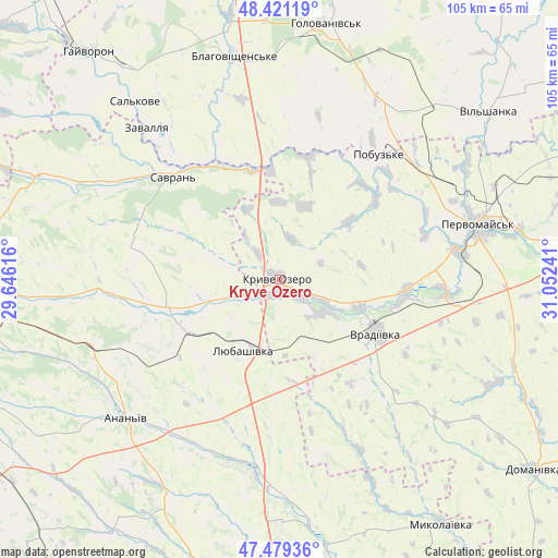
Kryve Ozero GPS coordinates[2]
47° 57' 8.712" North, 30° 20' 57.408" East
| Map corner | latitude | longitude |
|---|---|---|
| Upper-left | 48.42119°, | 29.64616° |
| Center: | 47.95242°, | 30.34928° |
| Lower-right: | 47.47936°, | 31.05241° |
| Map W x H: | 104.7×104.7 km | = 65.1×65.1mi |
| max Lat: | 52.18903° ⇑57.2% North |
| Kryve Ozero: | 47.95242° |
| min Lat: | ⇓42.8% South 44.39214° |
| min Long | Kryve Ozero | max Long |
| 22.20555° | 30.34928° | 40.13222° |
| W 34.3%⇐ | ⇒65.7% E |
Elevation
Elevation of Kryve Ozero is 96 m = 315 ft, and this is 59.8 m = 196 ft below average elevation for this country.
| Max E: |
886 m = 2907 ft | 63.3% |
| Avg. | 155.8 m = 511 ft | |
| Kryve Ozero | 96 m = 315 ft | |
Min E: |
-3 m = -10 ft | 36.7% |
See also: Ukraine elevation on elevation.city.
Geographical zone
Kryve Ozero is located in North temperate zone (between Tropic of Cancer and the Arctic Circle). Distance of this North polar circle is 2069.4 km =1285.9 mi to North.| Distance of | km | miles | from Kryve Ozero |
|---|---|---|---|
| North Pole | 4675.3 | 2905.1 | to North |
| Arctic Circle | 2069.4 | 1285.9 | to North |
| Tropic Cancer | 2725.9 | 1693.8 | to South |
| Equator | 5331.8 | 3313 | to South |


Nearby cities:
15 places around Kryve Ozero: (largest is in red/bold)
• Ananyiv Pershyi
39.6 km =24.6 mi,  229°
229°
• Balta
54.4 km =33.8 mi,  268°
268°
• Blahovishchens’ke
43.1 km =26.8 mi,  347°
347°
• Holovanivs’k
48.7 km =30.3 mi,  9°
9°
• Lyubashivka
14.4 km =8.9 mi,  207°
207°
• Myhiya
45.8 km =28.5 mi,  78°
78°
• Mykolayivka
54.9 km =34.1 mi,  146°
146°
• Pervomays’k
38.7 km =24 mi,  74°
74°
• Peschana
50 km =31.1 mi,  293°
293°
• Pidhorodna
43.7 km =27.2 mi, 66°
• Pobugskoye
29.8 km =18.5 mi,  37°
37°
• Savran
28.2 km =17.5 mi,  315°
315°
• Vil’shanka
50.2 km =31.2 mi,  51°
51°
• Vradiyivka
20.7 km =12.9 mi,  119°
119°
• Zavallya
38.2 km =23.7 mi, 319°
Sources, notices
• [Note1] Compared only with cities in Ukraine existing in our database
• [Src1] Map data: © OpenStreetMap contributors (CC-BY-SA)
• [Src2] Other city data from geonames.org with taken over terms of usage.
• [Src3] Geographical zone / Annual Mean Temperature by Robert A. Rohde @ Wikipedia
