Veselynove geodata
Veselynove (Mykolaiv) is a seat of a second-order administrative division; located in Ukraine in Europe/Kiev (GMT+3) time zone. With population of 6,997 people, there are 511 cities with bigger population in this country. Compared to other cities in Ukraine, 61.7% of cities are located further ↑North; 60.1% of cities are located further →East and 90.9% of cities have higher elevation than Veselynove. Note1


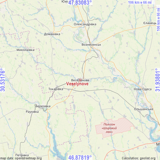
Veselynove GPS coordinates[2]
47° 21' 23.976" North, 31° 14' 5.568" East
| Map corner | latitude | longitude |
|---|---|---|
| Upper-left | 47.83083°, | 30.53176° |
| Center: | 47.35666°, | 31.23488° |
| Lower-right: | 46.87819°, | 31.93801° |
| Map W x H: | 105.9×105.9 km | = 65.8×65.8mi |
| max Lat: | 52.18903° ⇑61.7% North |
| Veselynove: | 47.35666° |
| min Lat: | ⇓38.3% South 44.39214° |
| min Long | Veselynove | max Long |
| 22.20555° | 31.23488° | 40.13222° |
| W 39.9%⇐ | ⇒60.1% E |
Elevation
Elevation of Veselynove is 18 m = 59 ft, and this is 137.8 m = 452 ft below average elevation for this country.
| Max E: |
886 m = 2907 ft | 90.9% |
| Avg. | 155.8 m = 511 ft | |
| Veselynove | 18 m = 59 ft | |
Min E: |
-3 m = -10 ft | 9.1% |
See also: Ukraine elevation on elevation.city.
Geographical zone
Veselynove is located in North temperate zone (between Tropic of Cancer and the Arctic Circle). Distance of this North polar circle is 2135.6 km =1327 mi to North.| Distance of | km | miles | from Veselynove |
|---|---|---|---|
| North Pole | 4741.5 | 2946.2 | to North |
| Arctic Circle | 2135.6 | 1327 | to North |
| Tropic Cancer | 2659.6 | 1652.6 | to South |
| Equator | 5265.6 | 3271.9 | to South |


Nearby cities:
15 places around Veselynove: (largest is in red/bold)
• Arbuzynka
61.8 km =38.4 mi,  5°
5°
• Berezanka
57.2 km =35.5 mi,  168°
168°
• Berezivka
29.9 km =18.6 mi,  235°
235°
• Brats’ke
62.1 km =38.6 mi,  24°
24°
• Dobroslav
64.5 km =40.1 mi,  200°
200°
• Domanivka
35.8 km =22.2 mi,  328°
328°
• Ivanivka
71.7 km =44.6 mi,  233°
233°
• Kostyantynivka
52.8 km =32.8 mi,  351°
351°
• Kurisove
47.8 km =29.7 mi,  205°
205°
• Mykolayivka
41.4 km =25.7 mi,  299°
299°
• Nova Odesa
41.8 km =26 mi,  97°
97°
• Ol'shanskoye
46.3 km =28.8 mi,  114°
114°
• Voznesensk
24.3 km =15.1 mi, 17°
• Yelanets’
59.8 km =37.2 mi,  50°
50°
• Yuzhnoukrains'k
51.4 km =31.9 mi,  355°
355°
Sources, notices
• [Note1] Compared only with cities in Ukraine existing in our database
• [Src1] Map data: © OpenStreetMap contributors (CC-BY-SA)
• [Src2] Other city data from geonames.org with taken over terms of usage.
• [Src3] Geographical zone / Annual Mean Temperature by Robert A. Rohde @ Wikipedia
