Kostyantynivka geodata
Kostyantynivka (Mykolaiv) is a populated place; located in Ukraine in Europe/Kiev (GMT+3) time zone. With population of 2,705 people, there are 1001 cities with bigger population in this country. Compared to other cities in Ukraine, 58.4% of cities are located further ↑North; 60.4% of cities are located further →East and 83.4% of cities have higher elevation than Kostyantynivka. Note1


Kostyantynivka GPS coordinates[2]
47° 49' 35.76" North, 31° 8' 7.836" East
| Map corner | latitude | longitude |
|---|---|---|
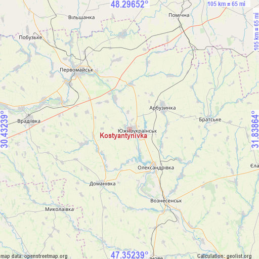
| Upper-left | 48.29652°, | 30.43239° |
| Center: | 47.8266°, | 31.13551° |
| Lower-right: | 47.35239°, | 31.83864° |
| Map W x H: | 105×105 km | = 65.2×65.2mi |
| max Lat: | 52.18903° ⇑58.4% North |
| Kostyantynivka: | 47.8266° |
| min Lat: | ⇓41.6% South 44.39214° |
| min Long | Kostyantynivka | max Long |
| 22.20555° | 31.13551° | 40.13222° |
| W 39.6%⇐ | ⇒60.4% E |
Elevation
Elevation of Kostyantynivka is 34 m = 112 ft, and this is 121.8 m = 400 ft below average elevation for this country.
| Max E: |
886 m = 2907 ft | 83.4% |
| Avg. | 155.8 m = 511 ft | |
| Kostyantynivka | 34 m = 112 ft | |
Min E: |
-3 m = -10 ft | 16.6% |
See also: Ukraine elevation on elevation.city.
Geographical zone
Kostyantynivka is located in North temperate zone (between Tropic of Cancer and the Arctic Circle). Distance of this North polar circle is 2083.4 km =1294.6 mi to North.| Distance of | km | miles | from Kostyantynivka |
|---|---|---|---|
| North Pole | 4689.2 | 2913.7 | to North |
| Arctic Circle | 2083.4 | 1294.6 | to North |
| Tropic Cancer | 2711.9 | 1685.1 | to South |
| Equator | 5317.8 | 3304.3 | to South |


Nearby cities:
15 places around Kostyantynivka: (largest is in red/bold)
• Arbuzynka
16.6 km =10.3 mi,  56°
56°
• Brats’ke
33.7 km =20.9 mi,  82°
82°
• Domanivka
24.3 km =15.1 mi,  206°
206°
• Lysa Hora
38.3 km =23.8 mi,  357°
357°
• Myhiya
27.1 km =16.8 mi,  329°
329°
• Mykolayivka
42.6 km =26.5 mi,  221°
221°
• Pervomays’k
32.2 km =20 mi,  318°
318°
• Pidhorodna
36.2 km =22.5 mi, 329°
• Pobugskoye
55.3 km =34.4 mi,  313°
313°
• Pomichna
50.7 km =31.5 mi,  24°
24°
• Veselynove
52.8 km =32.8 mi,  171°
171°
• Vil’shanka
49.4 km =30.7 mi,  337°
337°
• Voznesensk
32.6 km =20.3 mi,  153°
153°
• Vradiyivka
40.8 km =25.4 mi,  275°
275°
• Yuzhnoukrains'k
3.7 km =2.3 mi,  105°
105°
Sources, notices
• [Note1] Compared only with cities in Ukraine existing in our database
• [Src1] Map data: © OpenStreetMap contributors (CC-BY-SA)
• [Src2] Other city data from geonames.org with taken over terms of usage.
• [Src3] Geographical zone / Annual Mean Temperature by Robert A. Rohde @ Wikipedia
