Lyubeshiv geodata
Lyubeshiv (Volyn) is a seat of a second-order administrative division; located in Ukraine in Europe/Kiev (GMT+3) time zone. In our database, there are 1661 cities with bigger population. Compared to other cities in Ukraine, 99% of cities are located further ↓South; 83.6% of cities are located further →East and 53.9% of cities have lower elevation than Lyubeshiv. Note1


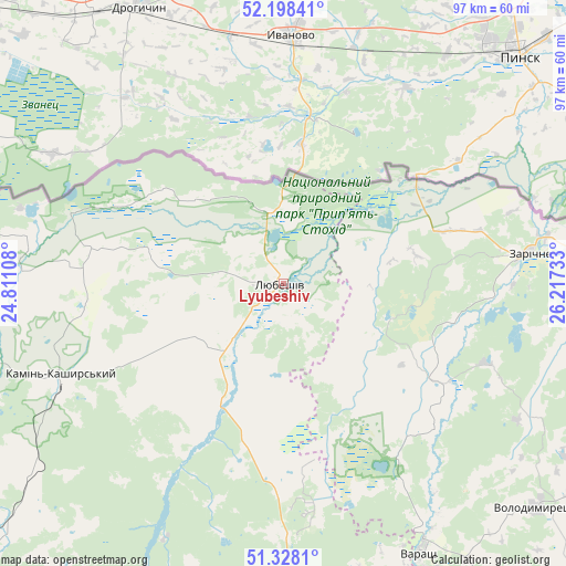
Lyubeshiv GPS coordinates[2]
51° 45' 55.26" North, 25° 30' 51.12" East
| Map corner | latitude | longitude |
|---|---|---|
| Upper-left | 52.19841°, | 24.81108° |
| Center: | 51.76535°, | 25.5142° |
| Lower-right: | 51.3281°, | 26.21733° |
| Map W x H: | 96.8×96.8 km | = 60.1×60.1mi |
| max Lat: | 52.18903° ⇑1% North |
| Lyubeshiv: | 51.76535° |
| min Lat: | ⇓99% South 44.39214° |
| min Long | Lyubeshiv | max Long |
| 22.20555° | 25.5142° | 40.13222° |
| W 16.4%⇐ | ⇒83.6% E |
Elevation
Elevation of Lyubeshiv is 149 m = 489 ft, and this is 6.8 m = 22 ft below average elevation for this country.
| Max E: |
886 m = 2907 ft | 46.1% |
| Avg. | 155.8 m = 511 ft | |
| Lyubeshiv | 149 m = 489 ft | |
Min E: |
-3 m = -10 ft | 53.9% |
See also: Ukraine elevation on elevation.city.
Geographical zone
Lyubeshiv is located in North temperate zone (between Tropic of Cancer and the Arctic Circle). Distance of this North polar circle is 1645.4 km =1022.4 mi to North.| Distance of | km | miles | from Lyubeshiv |
|---|---|---|---|
| North Pole | 4251.3 | 2641.6 | to North |
| Arctic Circle | 1645.4 | 1022.4 | to North |
| Tropic Cancer | 3149.8 | 1957.2 | to South |
| Equator | 5755.8 | 3576.5 | to South |


Nearby cities:
15 places around Lyubeshiv: (largest is in red/bold)
• Dubrovytsya
75.5 km =46.9 mi,  106°
106°
• Hołoby
83.2 km =51.7 mi,  204°
204°
• Kamin-Kashyrskyi
41.4 km =25.7 mi,  247°
247°
• Kovel
82.8 km =51.4 mi,  222°
222°
• Lukiv
79.7 km =49.5 mi,  185°
185°
• Manevychi
52.4 km =32.6 mi,  178°
178°
• Nuyno
48.3 km =30 mi,  239°
239°
• Pidrichchya
53.4 km =33.2 mi, 247°
• Rakiv Lis
43.7 km =27.2 mi, 248°
• Ratne
68.6 km =42.6 mi,  260°
260°
• Sarny
89 km =55.3 mi,  122°
122°
• Stara Vyzhivka
82.7 km =51.4 mi, 243°
• Varash
51.5 km =32 mi,  153°
153°
• Volodymyrets’
58 km =36 mi,  131°
131°
• Zarichne
42.6 km =26.5 mi,  82°
82°
Sources, notices
• [Note1] Compared only with cities in Ukraine existing in our database
• [Src1] Map data: © OpenStreetMap contributors (CC-BY-SA)
• [Src2] Other city data from geonames.org with taken over terms of usage.
• [Src3] Geographical zone / Annual Mean Temperature by Robert A. Rohde @ Wikipedia
