Rakiv Lis geodata
Rakiv Lis (Volyn) is a populated place; located in Ukraine in Europe/Kiev (GMT+3) time zone. With population of 2,958 people, there are 957 cities with bigger population in this country. Compared to other cities in Ukraine, 98.7% of cities are located further ↓South; 86.5% of cities are located further →East and 55.3% of cities have lower elevation than Rakiv Lis. Note1


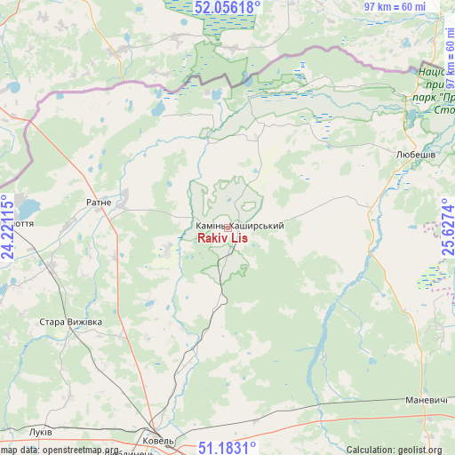
Rakiv Lis GPS coordinates[2]
51° 37' 18.264" North, 24° 55' 27.372" East
| Map corner | latitude | longitude |
|---|---|---|
| Upper-left | 52.05618°, | 24.22115° |
| Center: | 51.62174°, | 24.92427° |
| Lower-right: | 51.1831°, | 25.6274° |
| Map W x H: | 97.1×97.1 km | = 60.3×60.3mi |
| max Lat: | 52.18903° ⇑1.3% North |
| Rakiv Lis: | 51.62174° |
| min Lat: | ⇓98.7% South 44.39214° |
| min Long | Rakiv Lis | max Long |
| 22.20555° | 24.92427° | 40.13222° |
| W 13.5%⇐ | ⇒86.5% E |
Elevation
Elevation of Rakiv Lis is 153 m = 502 ft, and this is 2.8 m = 9 ft below average elevation for this country.
| Max E: |
886 m = 2907 ft | 44.7% |
| Avg. | 155.8 m = 511 ft | |
| Rakiv Lis | 153 m = 502 ft | |
Min E: |
-3 m = -10 ft | 55.3% |
See also: Ukraine elevation on elevation.city.
Geographical zone
Rakiv Lis is located in North temperate zone (between Tropic of Cancer and the Arctic Circle). Distance of this North polar circle is 1661.4 km =1032.3 mi to North.| Distance of | km | miles | from Rakiv Lis |
|---|---|---|---|
| North Pole | 4267.3 | 2651.6 | to North |
| Arctic Circle | 1661.4 | 1032.3 | to North |
| Tropic Cancer | 3133.9 | 1947.3 | to South |
| Equator | 5739.8 | 3566.5 | to South |


Nearby cities:
15 places around Rakiv Lis: (largest is in red/bold)
• Hołoby
59.8 km =37.2 mi,  174°
174°
• Kamin-Kashyrskyi
2.4 km =1.5 mi,  83°
83°
• Kovel
47.6 km =29.6 mi,  198°
198°
• Liuboml
75.6 km =47 mi,  234°
234°
• Lukiv
71.5 km =44.4 mi,  152°
152°
• Lyubeshiv
43.7 km =27.2 mi,  68°
68°
• Manevychi
55.8 km =34.7 mi,  130°
130°
• Nuyno
8.4 km =5.2 mi,  186°
186°
• Pidrichchya
9.7 km =6 mi,  244°
244°
• Ratne
27.7 km =17.2 mi,  280°
280°
• Shats’k
69.5 km =43.2 mi,  258°
258°
• Stara Vyzhivka
39.3 km =24.4 mi, 238°
• Svityaz’
75.3 km =46.8 mi, 258°
• Turiys’k
65.7 km =40.8 mi,  205°
205°
• Varash
70.7 km =43.9 mi,  115°
115°
Sources, notices
• [Note1] Compared only with cities in Ukraine existing in our database
• [Src1] Map data: © OpenStreetMap contributors (CC-BY-SA)
• [Src2] Other city data from geonames.org with taken over terms of usage.
• [Src3] Geographical zone / Annual Mean Temperature by Robert A. Rohde @ Wikipedia
