Kuznetsovo-Mykhaylivka geodata
Kuznetsovo-Mykhaylivka (Donetsk) is a populated place; located in Ukraine in Europe/Kiev (GMT+3) time zone. With population of 969 people, there are 1400 cities with bigger population in this country. Compared to other cities in Ukraine, 61% of cities are located further ↑North; 95.6% of cities are located further ←West and 80.6% of cities have higher elevation than Kuznetsovo-Mykhaylivka. Note1


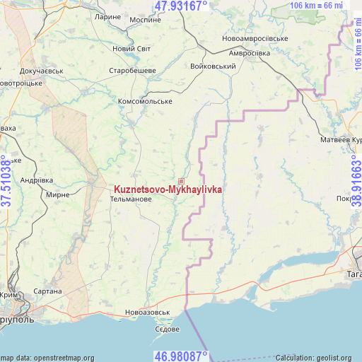
Kuznetsovo-Mykhaylivka GPS coordinates[2]
47° 27' 30.312" North, 38° 12' 48.6" East
| Map corner | latitude | longitude |
|---|---|---|
| Upper-left | 47.93167°, | 37.51038° |
| Center: | 47.45842°, | 38.2135° |
| Lower-right: | 46.98087°, | 38.91663° |
| Map W x H: | 105.7×105.7 km | = 65.7×65.7mi |
| max Lat: | 52.18903° ⇑61% North |
| Kuznetsovo-Mykhaylivka: | 47.45842° |
| min Lat: | ⇓39% South 44.39214° |
| min Long | Kuznetsovo-Mykh | max Long |
| 22.20555° | 38.2135° | 40.13222° |
| W 95.6%⇐ | ⇒4.4% E |
Elevation
Elevation of Kuznetsovo-Mykhaylivka is 41 m = 135 ft, and this is 114.8 m = 377 ft below average elevation for this country.
| Max E: |
886 m = 2907 ft | 80.6% |
| Avg. | 155.8 m = 511 ft | |
| Kuznetsovo-Mykhaylivka | 41 m = 135 ft | |
Min E: |
-3 m = -10 ft | 19.4% |
See also: Ukraine elevation on elevation.city.
Geographical zone
Kuznetsovo-Mykhaylivka is located in North temperate zone (between Tropic of Cancer and the Arctic Circle). Distance of this North polar circle is 2124.3 km =1320 mi to North.| Distance of | km | miles | from Kuznetsovo-Mykhaylivka |
|---|---|---|---|
| North Pole | 4730.2 | 2939.2 | to North |
| Arctic Circle | 2124.3 | 1320 | to North |
| Tropic Cancer | 2671 | 1659.7 | to South |
| Equator | 5276.9 | 3278.9 | to South |


Nearby cities:
15 places around Kuznetsovo-Mykhaylivka: (largest is in red/bold)
• Amvrosiyivka
42.2 km =26.2 mi,  27°
27°
• Bezimenne
44.2 km =27.5 mi,  208°
208°
• Blahodatne
51 km =31.7 mi,  23°
23°
• Boykivske
15.2 km =9.4 mi,  249°
249°
• Dokuchayevs’k
51.6 km =32.1 mi,  309°
309°
• Horbachevo-Mykhaylivka
46.3 km =28.8 mi,  340°
340°
• Ilovays’k
51.9 km =32.2 mi,  359°
359°
• Kuteynykove
39.7 km =24.7 mi,  8°
8°
• Mospyne
49.4 km =30.7 mi,  346°
346°
• Novoazovs'k
39.5 km =24.5 mi,  194°
194°
• Novyy Svit
41.2 km =25.6 mi, 339°
• Pikuzy
43.7 km =27.2 mi,  223°
223°
• Sartana
50.4 km =31.3 mi,  231°
231°
• Starobesheve
35.2 km =21.9 mi, 337°
• Syedove
42.7 km =26.5 mi, 185°
Sources, notices
• [Note1] Compared only with cities in Ukraine existing in our database
• [Src1] Map data: © OpenStreetMap contributors (CC-BY-SA)
• [Src2] Other city data from geonames.org with taken over terms of usage.
• [Src3] Geographical zone / Annual Mean Temperature by Robert A. Rohde @ Wikipedia
