Bilyayivka geodata
Bilyayivka (Odesa) is a seat of a second-order administrative division; located in Ukraine in Europe/Kiev (GMT+3) time zone. With population of 13,762 people, there are 275 cities with bigger population in this country. Compared to other cities in Ukraine, 67.2% of cities are located further ↑North; 66.6% of cities are located further →East and 98% of cities have higher elevation than Bilyayivka. Note1


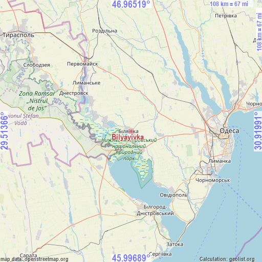
Bilyayivka GPS coordinates[2]
46° 28' 59.484" North, 30° 13' 0.408" East
| Map corner | latitude | longitude |
|---|---|---|
| Upper-left | 46.96519°, | 29.51366° |
| Center: | 46.48319°, | 30.21678° |
| Lower-right: | 45.99689°, | 30.91991° |
| Map W x H: | 107.7×107.7 km | = 66.9×66.9mi |
| max Lat: | 52.18903° ⇑67.2% North |
| Bilyayivka: | 46.48319° |
| min Lat: | ⇓32.8% South 44.39214° |
| min Long | Bilyayivka | max Long |
| 22.20555° | 30.21678° | 40.13222° |
| W 33.4%⇐ | ⇒66.6% E |
Elevation
Elevation of Bilyayivka is 7 m = 23 ft, and this is 148.8 m = 488 ft below average elevation for this country.
| Max E: |
886 m = 2907 ft | 98% |
| Avg. | 155.8 m = 511 ft | |
| Bilyayivka | 7 m = 23 ft | |
Min E: |
-3 m = -10 ft | 2% |
See also: Ukraine elevation on elevation.city.
Geographical zone
Bilyayivka is located in North temperate zone (between Tropic of Cancer and the Arctic Circle). Distance of this North polar circle is 2232.7 km =1387.3 mi to North.| Distance of | km | miles | from Bilyayivka |
|---|---|---|---|
| North Pole | 4838.6 | 3006.6 | to North |
| Arctic Circle | 2232.7 | 1387.3 | to North |
| Tropic Cancer | 2562.5 | 1592.3 | to South |
| Equator | 5168.4 | 3211.5 | to South |


Nearby cities:
15 places around Bilyayivka: (largest is in red/bold)
• Bilhorod-Dnistrovskyi
33.6 km =20.9 mi,  162°
162°
• Chornomors’k
39 km =24.2 mi,  120°
120°
• Lymanske
27.1 km =16.8 mi,  315°
315°
• Mayaky
8.5 km =5.3 mi,  148°
148°
• Odessa
39.5 km =24.5 mi,  90°
90°
• Oleksandrivka
36.4 km =22.6 mi, 118°
• Ovidiopol
31.1 km =19.3 mi, 146°
• Pavlivka
35.5 km =22.1 mi,  330°
330°
• Salhany
38.5 km =23.9 mi,  165°
165°
• Starokozache
24.1 km =15 mi,  227°
227°
• Stepanivka
38.8 km =24.1 mi, 333°
• Stepove
26.7 km =16.6 mi,  336°
336°
• Tayirove
35.7 km =22.2 mi,  111°
111°
• Teplodar
8.7 km =5.4 mi,  73°
73°
• Usatove
34.3 km =21.3 mi,  80°
80°
Sources, notices
• [Note1] Compared only with cities in Ukraine existing in our database
• [Src1] Map data: © OpenStreetMap contributors (CC-BY-SA)
• [Src2] Other city data from geonames.org with taken over terms of usage.
• [Src3] Geographical zone / Annual Mean Temperature by Robert A. Rohde @ Wikipedia
