Millerovo geodata
Millerovo (Luhansk) is a populated place; located in Ukraine in Europe/Zaporozhye (GMT+3) time zone. With population of 3,116 people, there are 906 cities with bigger population in this country. Compared to other cities in Ukraine, 53% of cities are located further ↑North; 98.8% of cities are located further ←West and 86.3% of cities have lower elevation than Millerovo. Note1


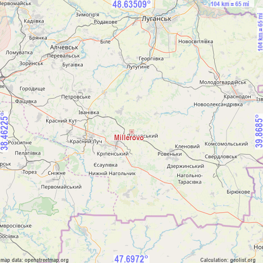
Millerovo GPS coordinates[2]
48° 10' 5.844" North, 39° 9' 55.332" East
| Map corner | latitude | longitude |
|---|---|---|
| Upper-left | 48.63509°, | 38.46225° |
| Center: | 48.16829°, | 39.16537° |
| Lower-right: | 47.6972°, | 39.8685° |
| Map W x H: | 104.3×104.3 km | = 64.8×64.8mi |
| max Lat: | 52.18903° ⇑53% North |
| Millerovo: | 48.16829° |
| min Lat: | ⇓47% South 44.39214° |
| min Long | Millerovo | max Long |
| 22.20555° | 39.16537° | 40.13222° |
| W 98.8%⇐ | ⇒1.2% E |
Elevation
Elevation of Millerovo is 282 m = 925 ft, and this is 126.2 m = 414 ft above average elevation for this country.
| Max E: |
886 m = 2907 ft | 13.7% |
| Millerovo | 282 m 925 ft | |
| Avg. | 155.8 m = 511 ft | |
Min E: |
-3 m = -10 ft | 86.3% |
See also: Ukraine elevation on elevation.city.
Geographical zone
Millerovo is located in North temperate zone (between Tropic of Cancer and the Arctic Circle). Distance of this North polar circle is 2045.4 km =1271 mi to North.| Distance of | km | miles | from Millerovo |
|---|---|---|---|
| North Pole | 4651.3 | 2890.2 | to North |
| Arctic Circle | 2045.4 | 1271 | to North |
| Tropic Cancer | 2749.9 | 1708.7 | to South |
| Equator | 5355.8 | 3327.9 | to South |


Nearby cities:
15 places around Millerovo: (largest is in red/bold)
• Antratsyt
8.1 km =5 mi,  222°
222°
• Dmytrivka
30.9 km =19.2 mi,  213°
213°
• Klenovyy
22.4 km =13.9 mi,  104°
104°
• Krasnyy Kut
27.5 km =17.1 mi,  277°
277°
• Krasnyy Luch
17.2 km =10.7 mi,  259°
259°
• Kripens’kyy
12.9 km =8 mi, 218°
• Lenina
29.1 km =18.1 mi,  357°
357°
• Lutuhyne
26.7 km =16.6 mi,  9°
9°
• Miusyns’k
21.9 km =13.6 mi,  242°
242°
• Roven’ky
18.4 km =11.4 mi,  120°
120°
• Simeykyne
32.4 km =20.1 mi,  57°
57°
• Snizhne
33.2 km =20.6 mi, 241°
• Teple
33.5 km =20.8 mi, 61°
• Uspenka
24.7 km =15.3 mi, 359°
• Zalesnoye
30.5 km =19 mi, 240°
Sources, notices
• [Note1] Compared only with cities in Ukraine existing in our database
• [Src1] Map data: © OpenStreetMap contributors (CC-BY-SA)
• [Src2] Other city data from geonames.org with taken over terms of usage.
• [Src3] Geographical zone / Annual Mean Temperature by Robert A. Rohde @ Wikipedia
