Antratsyt geodata
Antratsyt (Luhansk) is a seat of a second-order administrative division; located in Ukraine in Europe/Zaporozhye (GMT+3) time zone. With population of 61,600 people, there are 79 cities with bigger population in this country. Compared to other cities in Ukraine, 54.5% of cities are located further ↑North; 98.7% of cities are located further ←West and 77.2% of cities have lower elevation than Antratsyt. Note1


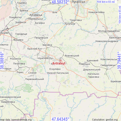
Antratsyt GPS coordinates[2]
48° 6' 54.108" North, 39° 5' 28.608" East
| Map corner | latitude | longitude |
|---|---|---|
| Upper-left | 48.58232°, | 38.38816° |
| Center: | 48.11503°, | 39.09128° |
| Lower-right: | 47.64345°, | 39.79441° |
| Map W x H: | 104.4×104.4 km | = 64.9×64.9mi |
| max Lat: | 52.18903° ⇑54.5% North |
| Antratsyt: | 48.11503° |
| min Lat: | ⇓45.5% South 44.39214° |
| min Long | Antratsyt | max Long |
| 22.20555° | 39.09128° | 40.13222° |
| W 98.7%⇐ | ⇒1.3% E |
Elevation
Elevation of Antratsyt is 235 m = 771 ft, and this is 79.2 m = 260 ft above average elevation for this country.
| Max E: |
886 m = 2907 ft | 22.8% |
| Antratsyt | 235 m 771 ft | |
| Avg. | 155.8 m = 511 ft | |
Min E: |
-3 m = -10 ft | 77.2% |
See also: Antratsyt elevation on elevation.city.
Geographical zone
Antratsyt is located in North temperate zone (between Tropic of Cancer and the Arctic Circle). Distance of this North polar circle is 2051.3 km =1274.6 mi to North.| Distance of | km | miles | from Antratsyt |
|---|---|---|---|
| North Pole | 4657.2 | 2893.8 | to North |
| Arctic Circle | 2051.3 | 1274.6 | to North |
| Tropic Cancer | 2744 | 1705 | to South |
| Equator | 5349.9 | 3324.3 | to South |


Nearby cities:
15 places around Antratsyt: (largest is in red/bold)
• Chystyakove
37.7 km =23.4 mi,  256°
256°
• Dmytrivka
23 km =14.3 mi,  210°
210°
• Klenovyy
27.3 km =17 mi,  88°
88°
• Krasnyy Kut
23.8 km =14.8 mi,  293°
293°
• Krasnyy Luch
11.8 km =7.3 mi,  283°
283°
• Kripens’kyy
4.9 km =3 mi, 210°
• Lenina
35.2 km =21.9 mi,  6°
6°
• Lutuhyne
33.8 km =21 mi,  17°
17°
• Millerovo
8.1 km =5 mi,  42°
42°
• Miusyns’k
14.5 km =9 mi,  253°
253°
• Roven’ky
21.6 km =13.4 mi,  99°
99°
• Rozsypne
38.4 km =23.9 mi, 275°
• Snizhne
25.7 km =16 mi, 247°
• Uspenka
31.1 km =19.3 mi, 9°
• Zalesnoye
22.9 km =14.2 mi, 245°
Sources, notices
• [Note1] Compared only with cities in Ukraine existing in our database
• [Src1] Map data: © OpenStreetMap contributors (CC-BY-SA)
• [Src2] Other city data from geonames.org with taken over terms of usage.
• [Src3] Geographical zone / Annual Mean Temperature by Robert A. Rohde @ Wikipedia
