Zalesnoye geodata
Zalesnoye (Luhansk) is a section of populated place; located in Ukraine in Europe/Kiev (GMT+3) time zone. With population of 2,539 people, there are 1026 cities with bigger population in this country. Compared to other cities in Ukraine, 56.3% of cities are located further ↑North; 97.9% of cities are located further ←West and 85.1% of cities have lower elevation than Zalesnoye. Note1


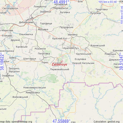
Zalesnoye GPS coordinates[2]
48° 1' 51.744" North, 38° 48' 33.624" East
| Map corner | latitude | longitude |
|---|---|---|
| Upper-left | 48.4991°, | 38.10622° |
| Center: | 48.03104°, | 38.80934° |
| Lower-right: | 47.55869°, | 39.51247° |
| Map W x H: | 104.6×104.6 km | = 65×65mi |
| max Lat: | 52.18903° ⇑56.3% North |
| Zalesnoye: | 48.03104° |
| min Lat: | ⇓43.7% South 44.39214° |
| min Long | Zalesnoye | max Long |
| 22.20555° | 38.80934° | 40.13222° |
| W 97.9%⇐ | ⇒2.1% E |
Elevation
Elevation of Zalesnoye is 275 m = 902 ft, and this is 119.2 m = 391 ft above average elevation for this country.
| Max E: |
886 m = 2907 ft | 14.9% |
| Zalesnoye | 275 m 902 ft | |
| Avg. | 155.8 m = 511 ft | |
Min E: |
-3 m = -10 ft | 85.1% |
See also: Ukraine elevation on elevation.city.
Geographical zone
Zalesnoye is located in North temperate zone (between Tropic of Cancer and the Arctic Circle). Distance of this North polar circle is 2060.6 km =1280.4 mi to North.| Distance of | km | miles | from Zalesnoye |
|---|---|---|---|
| North Pole | 4666.5 | 2899.6 | to North |
| Arctic Circle | 2060.6 | 1280.4 | to North |
| Tropic Cancer | 2734.6 | 1699.2 | to South |
| Equator | 5340.6 | 3318.5 | to South |


Nearby cities:
15 places around Zalesnoye: (largest is in red/bold)
• Amvrosiyivka
36.2 km =22.5 mi,  223°
223°
• Antratsyt
22.9 km =14.2 mi,  65°
65°
• Blahodatne
29.5 km =18.3 mi,  235°
235°
• Chornukhyne
38.8 km =24.1 mi,  326°
326°
• Chystyakove
15.8 km =9.8 mi,  273°
273°
• Dmytrivka
14.2 km =8.8 mi,  138°
138°
• Krasnyy Kut
19 km =11.8 mi,  357°
357°
• Krasnyy Luch
15.4 km =9.6 mi,  38°
38°
• Kripens’kyy
19.2 km =11.9 mi, 74°
• Millerovo
30.5 km =19 mi,  60°
60°
• Miusyns’k
8.7 km =5.4 mi,  53°
53°
• Rozsypne
21.8 km =13.5 mi,  307°
307°
• Shakhtars’k
27.7 km =17.2 mi,  275°
275°
• Snizhne
2.8 km =1.7 mi,  258°
258°
• Stizhkivs’ke
25.3 km =15.7 mi,  291°
291°
Sources, notices
• [Note1] Compared only with cities in Ukraine existing in our database
• [Src1] Map data: © OpenStreetMap contributors (CC-BY-SA)
• [Src2] Other city data from geonames.org with taken over terms of usage.
• [Src3] Geographical zone / Annual Mean Temperature by Robert A. Rohde @ Wikipedia
