Kalinino geodata
Kalinino (Republic of Crimea) is a seat of a third-order administrative division; located in Ukraine in Europe/Simferopol (GMT+3) time zone. With population of 1,640 people, there are 1181 cities with bigger population in this country. Compared to other cities in Ukraine, 72.6% of cities are located further ↑North; 57.1% of cities are located further ←West and 88.2% of cities have higher elevation than Kalinino. Note1
Administrative division(s):
- Level 1: Republic of Crimea
- Level 2: Pervomayskiy rayon
- Level 3: Kalininskoye sel'skoye poselenye


Kalinino GPS coordinates[2]
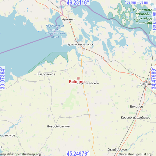
45° 44' 33.432" North, 33° 46' 36.336" East
| Map corner | latitude | longitude |
|---|---|---|
| Upper-left | 46.23116°, | 33.07364° |
| Center: | 45.74262°, | 33.77676° |
| Lower-right: | 45.24976°, | 34.47989° |
| Map W x H: | 109.1×109.1 km | = 67.8×67.8mi |
| max Lat: | 52.18903° ⇑72.6% North |
| Kalinino: | 45.74262° |
| min Lat: | ⇓27.4% South 44.39214° |
| min Long | Kalinino | max Long |
| 22.20555° | 33.77676° | 40.13222° |
| W 57.1%⇐ | ⇒42.9% E |
Elevation
Elevation of Kalinino is 22 m = 72 ft, and this is 133.8 m = 439 ft below average elevation for this country.
| Max E: |
886 m = 2907 ft | 88.2% |
| Avg. | 155.8 m = 511 ft | |
| Kalinino | 22 m = 72 ft | |
Min E: |
-3 m = -10 ft | 11.8% |
See also: Ukraine elevation on elevation.city.
Geographical zone
Kalinino is located in North temperate zone (between Tropic of Cancer and the Arctic Circle). Distance of this North polar circle is 2315.1 km =1438.5 mi to North.| Distance of | km | miles | from Kalinino |
|---|---|---|---|
| North Pole | 4921 | 3057.8 | to North |
| Arctic Circle | 2315.1 | 1438.5 | to North |
| Tropic Cancer | 2480.2 | 1541.1 | to South |
| Equator | 5086.1 | 3160.4 | to South |


Nearby cities:
15 places around Kalinino: (largest is in red/bold)
• Botanicheskoye
18.4 km =11.4 mi,  285°
285°
• Bratskoye
15 km =9.3 mi,  48°
48°
• Dolinka
18.4 km =11.4 mi,  43°
43°
• Grishino
11.9 km =7.4 mi,  159°
159°
• Ilyinka
8.5 km =5.3 mi,  9°
9°
• Krest’yanovka
12.8 km =8 mi,  99°
99°
• Kumovo
16.2 km =10.1 mi,  311°
311°
• Novopavlovka
16.3 km =10.1 mi,  32°
32°
• Oktyabr’skoye
16.5 km =10.3 mi,  125°
125°
• Orlovskoye
17 km =10.6 mi,  63°
63°
• Pervomayskoye
6.8 km =4.2 mi,  114°
114°
• Pravda
6.8 km =4.2 mi, 53°
• Ruch’i
10.2 km =6.3 mi,  298°
298°
• Sary-Bash
19.1 km =11.9 mi,  177°
177°
• Stepnoye
10.1 km =6.3 mi, 181°
Sources, notices
• [Note1] Compared only with cities in Ukraine existing in our database
• [Src1] Map data: © OpenStreetMap contributors (CC-BY-SA)
• [Src2] Other city data from geonames.org with taken over terms of usage.
• [Src3] Geographical zone / Annual Mean Temperature by Robert A. Rohde @ Wikipedia
