Sary-Bash geodata
Sary-Bash (Republic of Crimea) is a seat of a third-order administrative division; located in Ukraine in Europe/Simferopol (GMT+3) time zone. With population of 835 people, there are 1467 cities with bigger population in this country. Compared to other cities in Ukraine, 75.8% of cities are located further ↑North; 57.4% of cities are located further ←West and 59.1% of cities have higher elevation than Sary-Bash. Note1
Administrative division(s):
- Level 1: Republic of Crimea
- Level 2: Pervomayskiy rayon
- Level 3: Sarybashskoye sel'skoye poselenye


Sary-Bash GPS coordinates[2]
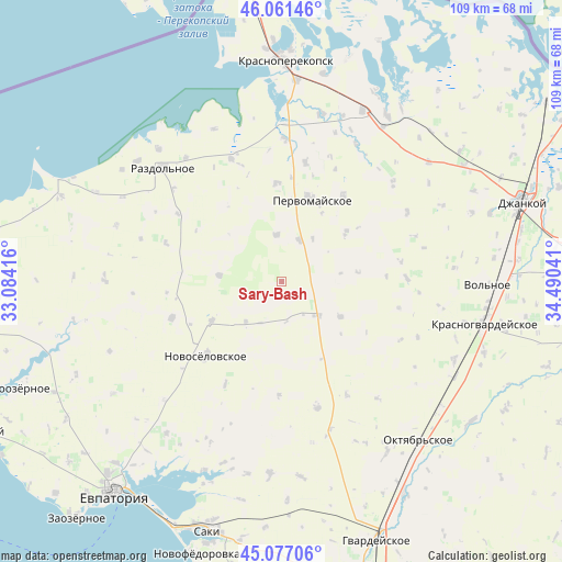
45° 34' 17.112" North, 33° 47' 14.208" East
| Map corner | latitude | longitude |
|---|---|---|
| Upper-left | 46.06146°, | 33.08416° |
| Center: | 45.57142°, | 33.78728° |
| Lower-right: | 45.07706°, | 34.49041° |
| Map W x H: | 109.5×109.5 km | = 68×68mi |
| max Lat: | 52.18903° ⇑75.8% North |
| Sary-Bash: | 45.57142° |
| min Lat: | ⇓24.2% South 44.39214° |
| min Long | Sary-Bash | max Long |
| 22.20555° | 33.78728° | 40.13222° |
| W 57.4%⇐ | ⇒42.6% E |
Elevation
Elevation of Sary-Bash is 108 m = 354 ft, and this is 47.8 m = 157 ft below average elevation for this country.
| Max E: |
886 m = 2907 ft | 59.1% |
| Avg. | 155.8 m = 511 ft | |
| Sary-Bash | 108 m = 354 ft | |
Min E: |
-3 m = -10 ft | 40.9% |
See also: Ukraine elevation on elevation.city.
Geographical zone
Sary-Bash is located in North temperate zone (between Tropic of Cancer and the Arctic Circle). Distance of this North polar circle is 2334.1 km =1450.3 mi to North.| Distance of | km | miles | from Sary-Bash |
|---|---|---|---|
| North Pole | 4940 | 3069.6 | to North |
| Arctic Circle | 2334.1 | 1450.3 | to North |
| Tropic Cancer | 2461.1 | 1529.3 | to South |
| Equator | 5067.1 | 3148.5 | to South |


Nearby cities:
15 places around Sary-Bash: (largest is in red/bold)
• Alekseyevka
12.3 km =7.6 mi,  275°
275°
• Chernovo
13.4 km =8.3 mi,  121°
121°
• Grishino
8.6 km =5.3 mi,  23°
23°
• Hvardiiske
14.8 km =9.2 mi,  83°
83°
• Il’inka
22.1 km =13.7 mi,  181°
181°
• Kalinino
19.1 km =11.9 mi,  357°
357°
• Kormovoye
15.8 km =9.8 mi,  239°
239°
• Krest’yanovka
20.6 km =12.8 mi,  35°
35°
• Novoselovskoye
20.6 km =12.8 mi,  225°
225°
• Oktyabr’skoye
15.7 km =9.8 mi,  53°
53°
• Pervomayskoye
17.1 km =10.6 mi, 18°
• Stepnoye
9 km =5.6 mi,  353°
353°
• Susanino
10.6 km =6.6 mi,  220°
220°
• Voykovo
9.5 km =5.9 mi,  133°
133°
• Zimino
22.4 km =13.9 mi,  251°
251°
Sources, notices
• [Note1] Compared only with cities in Ukraine existing in our database
• [Src1] Map data: © OpenStreetMap contributors (CC-BY-SA)
• [Src2] Other city data from geonames.org with taken over terms of usage.
• [Src3] Geographical zone / Annual Mean Temperature by Robert A. Rohde @ Wikipedia
