Hubkiv geodata
Hubkiv (Rivne) is a populated place; located in Ukraine in Europe/Kiev (GMT+3) time zone. With population of 788 people, there are 1490 cities with bigger population in this country. Compared to other cities in Ukraine, 94.5% of cities are located further ↓South; 77.9% of cities are located further →East and 66.8% of cities have lower elevation than Hubkiv. Note1


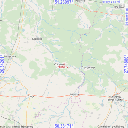
Hubkiv GPS coordinates[2]
50° 49' 40.62" North, 27° 2' 44.628" East
| Map corner | latitude | longitude |
|---|---|---|
| Upper-left | 51.26997°, | 26.34261° |
| Center: | 50.82795°, | 27.04573° |
| Lower-right: | 50.38171°, | 27.74886° |
| Map W x H: | 98.8×98.8 km | = 61.4×61.4mi |
| max Lat: | 52.18903° ⇑5.5% North |
| Hubkiv: | 50.82795° |
| min Lat: | ⇓94.5% South 44.39214° |
| min Long | Hubkiv | max Long |
| 22.20555° | 27.04573° | 40.13222° |
| W 22.1%⇐ | ⇒77.9% E |
Elevation
Elevation of Hubkiv is 193 m = 633 ft, and this is 37.2 m = 122 ft above average elevation for this country.
| Max E: |
886 m = 2907 ft | 33.2% |
| Hubkiv | 193 m 633 ft | |
| Avg. | 155.8 m = 511 ft | |
Min E: |
-3 m = -10 ft | 66.8% |
See also: Ukraine elevation on elevation.city.
Geographical zone
Hubkiv is located in North temperate zone (between Tropic of Cancer and the Arctic Circle). Distance of this North polar circle is 1749.6 km =1087.2 mi to North.| Distance of | km | miles | from Hubkiv |
|---|---|---|---|
| North Pole | 4355.5 | 2706.4 | to North |
| Arctic Circle | 1749.6 | 1087.2 | to North |
| Tropic Cancer | 3045.6 | 1892.4 | to South |
| Equator | 5651.5 | 3511.7 | to South |


Nearby cities:
15 places around Hubkiv: (largest is in red/bold)
• Berezne
28.2 km =17.5 mi,  312°
312°
• Horodnytsya
19.2 km =11.9 mi,  96°
96°
• Horodyshche
52.2 km =32.4 mi,  246°
246°
• Hoshcha
36.4 km =22.6 mi,  225°
225°
• Kolodenka
58 km =36 mi,  242°
242°
• Koloniya Zastav’ye
1.5 km =0.9 mi,  214°
214°
• Korets
24.9 km =15.5 mi,  161°
161°
• Kostopil’
42.1 km =26.2 mi,  277°
277°
• Netishyn
61.3 km =38.1 mi, 207°
• Novohrad-Volynskyi
47.9 km =29.8 mi,  122°
122°
• Olevs’k
61.2 km =38 mi,  43°
43°
• Rokytne
51.6 km =32.1 mi,  13°
13°
• Slavuta
59.9 km =37.2 mi,  192°
192°
• Velyki Mezhyrichi
23.1 km =14.4 mi, 213°
• Yemil’chyne
53.6 km =33.3 mi,  84°
84°
Sources, notices
• [Note1] Compared only with cities in Ukraine existing in our database
• [Src1] Map data: © OpenStreetMap contributors (CC-BY-SA)
• [Src2] Other city data from geonames.org with taken over terms of usage.
• [Src3] Geographical zone / Annual Mean Temperature by Robert A. Rohde @ Wikipedia
