Verkhovyna geodata
Verkhovyna (Ivano-Frankivsk) is a seat of a second-order administrative division; located in Ukraine in Europe/Kiev (GMT+3) time zone. With population of 5,290 people, there are 623 cities with bigger population in this country. Compared to other cities in Ukraine, 53.3% of cities are located further ↑North; 87.3% of cities are located further →East and 99.3% of cities have lower elevation than Verkhovyna. Note1


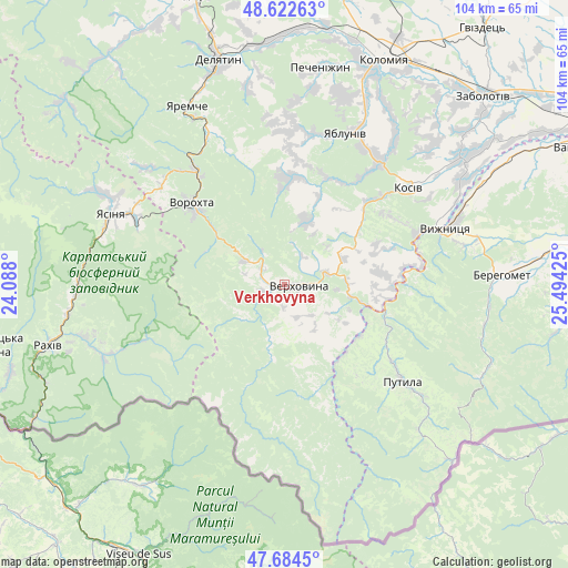
Verkhovyna GPS coordinates[2]
48° 9' 20.556" North, 24° 47' 28.032" East
| Map corner | latitude | longitude |
|---|---|---|
| Upper-left | 48.62263°, | 24.088° |
| Center: | 48.15571°, | 24.79112° |
| Lower-right: | 47.6845°, | 25.49425° |
| Map W x H: | 104.3×104.3 km | = 64.8×64.8mi |
| max Lat: | 52.18903° ⇑53.3% North |
| Verkhovyna: | 48.15571° |
| min Lat: | ⇓46.7% South 44.39214° |
| min Long | Verkhovyna | max Long |
| 22.20555° | 24.79112° | 40.13222° |
| W 12.7%⇐ | ⇒87.3% E |
Elevation
Elevation of Verkhovyna is 629 m = 2064 ft, and this is 473.2 m = 1552 ft above average elevation for this country.
| Max E: |
886 m = 2907 ft | 0.7% |
| Verkhovyna | 629 m 2064 ft | |
| Avg. | 155.8 m = 511 ft | |
Min E: |
-3 m = -10 ft | 99.3% |
See also: Ukraine elevation on elevation.city.
Geographical zone
Verkhovyna is located in North temperate zone (between Tropic of Cancer and the Arctic Circle). Distance of this North polar circle is 2046.8 km =1271.8 mi to North.| Distance of | km | miles | from Verkhovyna |
|---|---|---|---|
| North Pole | 4652.6 | 2891 | to North |
| Arctic Circle | 2046.8 | 1271.8 | to North |
| Tropic Cancer | 2748.5 | 1707.8 | to South |
| Equator | 5354.4 | 3327.1 | to South |


Nearby cities:
15 places around Verkhovyna: (largest is in red/bold)
• Kosiv
28.4 km =17.6 mi,  52°
52°
• Kosmach
19.5 km =12.1 mi,  6°
6°
• Krivopol’ye
8.3 km =5.2 mi,  301°
301°
• Kuty
31 km =19.3 mi,  68°
68°
• Lazeshchyna
30.2 km =18.8 mi,  294°
294°
• Putyla
29.2 km =18.1 mi,  129°
129°
• Rechka
17.4 km =10.8 mi,  37°
37°
• Sheshory
24.2 km =15 mi, 35°
• Stari Kuty
31.1 km =19.3 mi, 65°
• Tatariv
26.3 km =16.3 mi,  323°
323°
• Verkhniy Yasenov
11.5 km =7.1 mi,  86°
86°
• Vorokhta
22 km =13.7 mi,  310°
310°
• Vyzhnytsya
31.6 km =19.6 mi, 71°
• Yabluniv
29.7 km =18.5 mi,  21°
21°
• Yablunytsya
29 km =18 mi, 308°
Sources, notices
• [Note1] Compared only with cities in Ukraine existing in our database
• [Src1] Map data: © OpenStreetMap contributors (CC-BY-SA)
• [Src2] Other city data from geonames.org with taken over terms of usage.
• [Src3] Geographical zone / Annual Mean Temperature by Robert A. Rohde @ Wikipedia
