Biryukove geodata
Biryukove (Luhansk) is a populated place; located in Ukraine in Europe/Zaporozhye (GMT+3) time zone. With population of 4,250 people, there are 731 cities with bigger population in this country. Compared to other cities in Ukraine, 57.1% of cities are located further ↑North; 99.8% of cities are located further ←West and 69.5% of cities have lower elevation than Biryukove. Note1


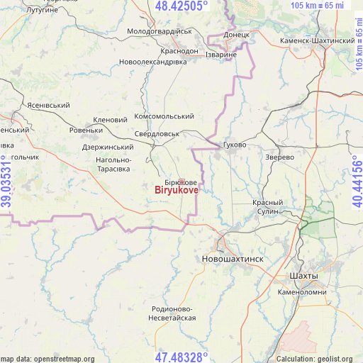
Biryukove GPS coordinates[2]
47° 57' 22.716" North, 39° 44' 18.348" East
| Map corner | latitude | longitude |
|---|---|---|
| Upper-left | 48.42505°, | 39.03531° |
| Center: | 47.95631°, | 39.73843° |
| Lower-right: | 47.48328°, | 40.44156° |
| Map W x H: | 104.7×104.7 km | = 65.1×65.1mi |
| max Lat: | 52.18903° ⇑57.1% North |
| Biryukove: | 47.95631° |
| min Lat: | ⇓42.9% South 44.39214° |
| min Long | Biryukove | max Long |
| 22.20555° | 39.73843° | 40.13222° |
| W 99.8%⇐ | ⇒0.2% E |
Elevation
Elevation of Biryukove is 204 m = 669 ft, and this is 48.2 m = 158 ft above average elevation for this country.
| Max E: |
886 m = 2907 ft | 30.5% |
| Biryukove | 204 m 669 ft | |
| Avg. | 155.8 m = 511 ft | |
Min E: |
-3 m = -10 ft | 69.5% |
See also: Ukraine elevation on elevation.city.
Geographical zone
Biryukove is located in North temperate zone (between Tropic of Cancer and the Arctic Circle). Distance of this North polar circle is 2068.9 km =1285.6 mi to North.| Distance of | km | miles | from Biryukove |
|---|---|---|---|
| North Pole | 4674.8 | 2904.8 | to North |
| Arctic Circle | 2068.9 | 1285.6 | to North |
| Tropic Cancer | 2726.3 | 1694 | to South |
| Equator | 5332.2 | 3313.3 | to South |


Nearby cities:
15 places around Biryukove: (largest is in red/bold)
• Antratsyt
51.2 km =31.8 mi,  290°
290°
• Buran
39.3 km =24.4 mi,  346°
346°
• Chervonopartyzans’k
14 km =8.7 mi,  17°
17°
• Dmytrivka
59.8 km =37.2 mi,  267°
267°
• Klenovyy
27.6 km =17.1 mi,  311°
311°
• Kripens’kyy
52.4 km =32.6 mi,  284°
284°
• Lutuhyne
62.7 km =39 mi,  322°
322°
• Millerovo
48.7 km =30.3 mi,  298°
298°
• Molodohvardiys’k
43.7 km =27.2 mi, 351°
• Roven’ky
30.3 km =18.8 mi, 297°
• Simeykyne
43.9 km =27.3 mi,  339°
339°
• Sorokyne
37.4 km =23.2 mi,  0°
0°
• Sverdlovs’k
16.1 km =10 mi, 336°
• Teple
41.7 km =25.9 mi, 341°
• Uralo-Kavkaz
40.8 km =25.4 mi,  6°
6°
Sources, notices
• [Note1] Compared only with cities in Ukraine existing in our database
• [Src1] Map data: © OpenStreetMap contributors (CC-BY-SA)
• [Src2] Other city data from geonames.org with taken over terms of usage.
• [Src3] Geographical zone / Annual Mean Temperature by Robert A. Rohde @ Wikipedia
