Sorokyne geodata
Sorokyne (Luhansk) is a seat of a second-order administrative division; located in Ukraine in Europe/Zaporozhye (GMT+3) time zone. With population of 49,352 people, there are 99 cities with bigger population in this country. Compared to other cities in Ukraine, 50.2% of cities are located further ↑North; 99.8% of cities are located further ←West and 52.3% of cities have lower elevation than Sorokyne. Note1


Sorokyne GPS coordinates[2]
48° 17' 32.46" North, 39° 44' 21.156" East
| Map corner | latitude | longitude |
|---|---|---|
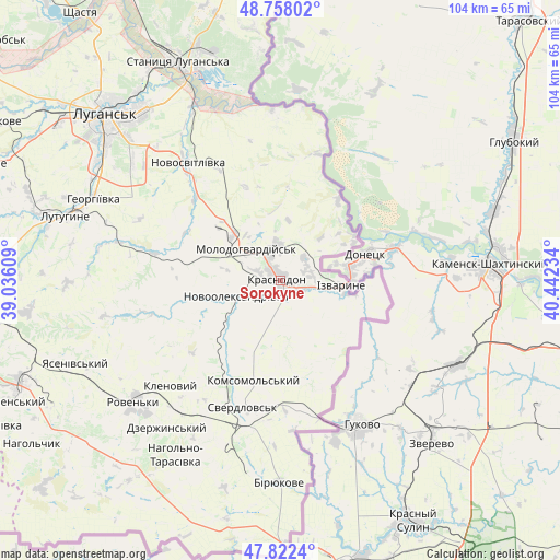
| Upper-left | 48.75802°, | 39.03609° |
| Center: | 48.29235°, | 39.73921° |
| Lower-right: | 47.8224°, | 40.44234° |
| Map W x H: | 104×104 km | = 64.6×64.6mi |
| max Lat: | 52.18903° ⇑50.2% North |
| Sorokyne: | 48.29235° |
| min Lat: | ⇓49.8% South 44.39214° |
| min Long | Sorokyne | max Long |
| 22.20555° | 39.73921° | 40.13222° |
| W 99.8%⇐ | ⇒0.2% E |
Elevation
Elevation of Sorokyne is 143 m = 469 ft, and this is 12.8 m = 42 ft below average elevation for this country.
| Max E: |
886 m = 2907 ft | 47.7% |
| Avg. | 155.8 m = 511 ft | |
| Sorokyne | 143 m = 469 ft | |
Min E: |
-3 m = -10 ft | 52.3% |
See also: Sorokyne elevation on elevation.city.
Geographical zone
Sorokyne is located in North temperate zone (between Tropic of Cancer and the Arctic Circle). Distance of this North polar circle is 2031.6 km =1262.4 mi to North.| Distance of | km | miles | from Sorokyne |
|---|---|---|---|
| North Pole | 4637.5 | 2881.6 | to North |
| Arctic Circle | 2031.6 | 1262.4 | to North |
| Tropic Cancer | 2763.7 | 1717.3 | to South |
| Equator | 5369.6 | 3336.5 | to South |


Nearby cities:
15 places around Sorokyne: (largest is in red/bold)
• Biryukove
37.4 km =23.2 mi,  180°
180°
• Buran
9.2 km =5.7 mi,  275°
275°
• Chervonopartyzans’k
24.4 km =15.2 mi,  170°
170°
• Klenovyy
28.3 km =17.6 mi,  227°
227°
• Luhansk
43.6 km =27.1 mi,  314°
314°
• Lutuhyne
39.9 km =24.8 mi,  288°
288°
• Makariv Yar
31.8 km =19.8 mi,  357°
357°
• Molodohvardiys’k
8.7 km =5.4 mi, 312°
• Roven’ky
35.5 km =22.1 mi, 229°
• Rozkishne
40.5 km =25.2 mi,  302°
302°
• Simeykyne
15.7 km =9.8 mi, 283°
• Sverdlovs’k
23.4 km =14.5 mi,  195°
195°
• Teple
13.2 km =8.2 mi, 279°
• Uralo-Kavkaz
5.7 km =3.5 mi,  55°
55°
• Uspenka
44 km =27.3 mi, 284°
Sources, notices
• [Note1] Compared only with cities in Ukraine existing in our database
• [Src1] Map data: © OpenStreetMap contributors (CC-BY-SA)
• [Src2] Other city data from geonames.org with taken over terms of usage.
• [Src3] Geographical zone / Annual Mean Temperature by Robert A. Rohde @ Wikipedia
