Berezanka geodata
Berezanka (Mykolaiv) is a seat of a second-order administrative division; located in Ukraine in Europe/Kiev (GMT+3) time zone. With population of 4,090 people, there are 750 cities with bigger population in this country. Compared to other cities in Ukraine, 64.5% of cities are located further ↑North; 59.7% of cities are located further →East and 93% of cities have higher elevation than Berezanka. Note1


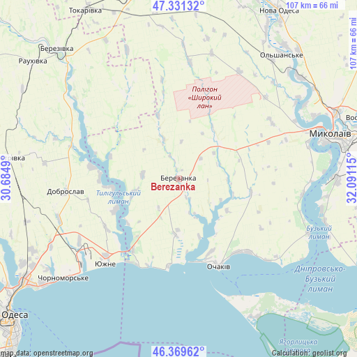
Berezanka GPS coordinates[2]
46° 51' 9.432" North, 31° 23' 16.872" East
| Map corner | latitude | longitude |
|---|---|---|
| Upper-left | 47.33132°, | 30.6849° |
| Center: | 46.85262°, | 31.38802° |
| Lower-right: | 46.36962°, | 32.09115° |
| Map W x H: | 106.9×106.9 km | = 66.4×66.4mi |
| max Lat: | 52.18903° ⇑64.5% North |
| Berezanka: | 46.85262° |
| min Lat: | ⇓35.5% South 44.39214° |
| min Long | Berezanka | max Long |
| 22.20555° | 31.38802° | 40.13222° |
| W 40.3%⇐ | ⇒59.7% E |
Elevation
Elevation of Berezanka is 15 m = 49 ft, and this is 140.8 m = 462 ft below average elevation for this country.
| Max E: |
886 m = 2907 ft | 93% |
| Avg. | 155.8 m = 511 ft | |
| Berezanka | 15 m = 49 ft | |
Min E: |
-3 m = -10 ft | 7% |
See also: Ukraine elevation on elevation.city.
Geographical zone
Berezanka is located in North temperate zone (between Tropic of Cancer and the Arctic Circle). Distance of this North polar circle is 2191.7 km =1361.9 mi to North.| Distance of | km | miles | from Berezanka |
|---|---|---|---|
| North Pole | 4797.5 | 2981 | to North |
| Arctic Circle | 2191.7 | 1361.9 | to North |
| Tropic Cancer | 2603.6 | 1617.8 | to South |
| Equator | 5209.5 | 3237 | to South |


Nearby cities:
15 places around Berezanka: (largest is in red/bold)
• Berezivka
53.4 km =33.2 mi,  317°
317°
• Dobroslav
34.4 km =21.4 mi,  262°
262°
• Fontanka
51.3 km =31.9 mi,  231°
231°
• Kobleve
25 km =15.5 mi,  213°
213°
• Krasnosilka
53.3 km =33.1 mi,  241°
241°
• Kremidivka
47.8 km =29.7 mi,  253°
253°
• Kryzhanivka
55.6 km =34.5 mi, 234°
• Kurisove
35.1 km =21.8 mi,  291°
291°
• Mykolayiv
48 km =29.8 mi,  74°
74°
• Ochakiv
29.4 km =18.3 mi,  155°
155°
• Ol'shanskoye
48 km =29.8 mi,  39°
39°
• Parutyne
42.1 km =26.2 mi,  112°
112°
• Rybakivka
26.3 km =16.3 mi,  186°
186°
• Yuzhne
33.7 km =20.9 mi,  220°
220°
• Геройское
54 km =33.6 mi,  134°
134°
Sources, notices
• [Note1] Compared only with cities in Ukraine existing in our database
• [Src1] Map data: © OpenStreetMap contributors (CC-BY-SA)
• [Src2] Other city data from geonames.org with taken over terms of usage.
• [Src3] Geographical zone / Annual Mean Temperature by Robert A. Rohde @ Wikipedia
