Ol'shanskoye geodata
Ol'shanskoye (Mykolaiv) is a populated place; located in Ukraine in Europe/Kiev (GMT+3) time zone. With population of 4,500 people, there are 702 cities with bigger population in this country. Compared to other cities in Ukraine, 62.7% of cities are located further ↑North; 58% of cities are located further →East and 71.8% of cities have higher elevation than Ol'shanskoye. Note1


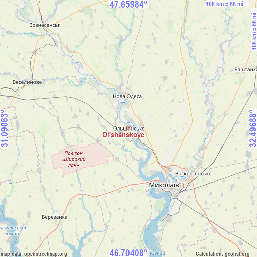
Ol'shanskoye GPS coordinates[2]
47° 11' 2.796" North, 31° 47' 37.5" East
| Map corner | latitude | longitude |
|---|---|---|
| Upper-left | 47.65984°, | 31.09063° |
| Center: | 47.18411°, | 31.79375° |
| Lower-right: | 46.70408°, | 32.49688° |
| Map W x H: | 106.3×106.3 km | = 66.1×66.1mi |
| max Lat: | 52.18903° ⇑62.7% North |
| Ol'shanskoye: | 47.18411° |
| min Lat: | ⇓37.3% South 44.39214° |
| min Long | Ol'shanskoye | max Long |
| 22.20555° | 31.79375° | 40.13222° |
| W 42%⇐ | ⇒58% E |
Elevation
Elevation of Ol'shanskoye is 70 m = 230 ft, and this is 85.8 m = 281 ft below average elevation for this country.
| Max E: |
886 m = 2907 ft | 71.8% |
| Avg. | 155.8 m = 511 ft | |
| Ol'shanskoye | 70 m = 230 ft | |
Min E: |
-3 m = -10 ft | 28.2% |
See also: Ukraine elevation on elevation.city.
Geographical zone
Ol'shanskoye is located in North temperate zone (between Tropic of Cancer and the Arctic Circle). Distance of this North polar circle is 2154.8 km =1338.9 mi to North.| Distance of | km | miles | from Ol'shanskoye |
|---|---|---|---|
| North Pole | 4760.7 | 2958.2 | to North |
| Arctic Circle | 2154.8 | 1338.9 | to North |
| Tropic Cancer | 2640.5 | 1640.7 | to South |
| Equator | 5246.4 | 3260 | to South |


Nearby cities:
15 places around Ol'shanskoye: (largest is in red/bold)
• Bashtanka
54.6 km =33.9 mi,  62°
62°
• Berezanka
48 km =29.8 mi,  219°
219°
• Berezivka
67 km =41.6 mi,  271°
271°
• Kobleve
72.9 km =45.3 mi, 217°
• Kurisove
67.6 km =42 mi,  249°
249°
• Mykolayiv
28.7 km =17.8 mi,  147°
147°
• Nova Odesa
13.8 km =8.6 mi,  357°
357°
• Ochakiv
66.2 km =41.1 mi,  196°
196°
• Parutyne
53.8 km =33.4 mi,  171°
171°
• Rybakivka
71.5 km =44.4 mi,  208°
208°
• Shevchenkove
47.3 km =29.4 mi,  138°
138°
• Stanislav
73.5 km =45.7 mi,  158°
158°
• Veselynove
46.3 km =28.8 mi,  294°
294°
• Voznesensk
54.8 km =34.1 mi,  320°
320°
• Yelanets’
57.2 km =35.5 mi,  4°
4°
Sources, notices
• [Note1] Compared only with cities in Ukraine existing in our database
• [Src1] Map data: © OpenStreetMap contributors (CC-BY-SA)
• [Src2] Other city data from geonames.org with taken over terms of usage.
• [Src3] Geographical zone / Annual Mean Temperature by Robert A. Rohde @ Wikipedia
