Snihurivka geodata
Snihurivka (Mykolaiv) is a seat of a second-order administrative division; located in Ukraine in Europe/Kiev (GMT+3) time zone. With population of 14,873 people, there are 258 cities with bigger population in this country. Compared to other cities in Ukraine, 63.5% of cities are located further ↑North; 53.5% of cities are located further →East and 77.9% of cities have higher elevation than Snihurivka. Note1


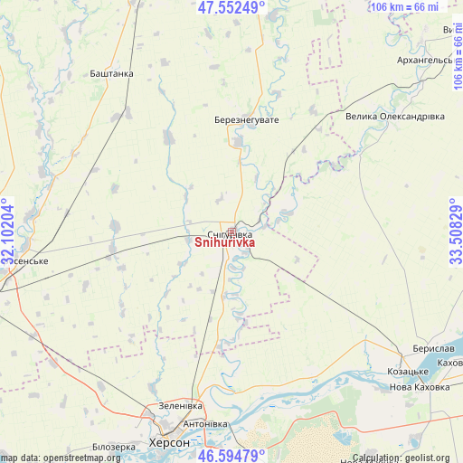
Snihurivka GPS coordinates[2]
47° 4' 32.844" North, 32° 48' 18.576" East
| Map corner | latitude | longitude |
|---|---|---|
| Upper-left | 47.55249°, | 32.10204° |
| Center: | 47.07579°, | 32.80516° |
| Lower-right: | 46.59479°, | 33.50829° |
| Map W x H: | 106.5×106.5 km | = 66.2×66.2mi |
| max Lat: | 52.18903° ⇑63.5% North |
| Snihurivka: | 47.07579° |
| min Lat: | ⇓36.5% South 44.39214° |
| min Long | Snihurivka | max Long |
| 22.20555° | 32.80516° | 40.13222° |
| W 46.5%⇐ | ⇒53.5% E |
Elevation
Elevation of Snihurivka is 51 m = 167 ft, and this is 104.8 m = 344 ft below average elevation for this country.
| Max E: |
886 m = 2907 ft | 77.9% |
| Avg. | 155.8 m = 511 ft | |
| Snihurivka | 51 m = 167 ft | |
Min E: |
-3 m = -10 ft | 22.1% |
See also: Ukraine elevation on elevation.city.
Geographical zone
Snihurivka is located in North temperate zone (between Tropic of Cancer and the Arctic Circle). Distance of this North polar circle is 2166.8 km =1346.4 mi to North.| Distance of | km | miles | from Snihurivka |
|---|---|---|---|
| North Pole | 4772.7 | 2965.6 | to North |
| Arctic Circle | 2166.8 | 1346.4 | to North |
| Tropic Cancer | 2628.4 | 1633.2 | to South |
| Equator | 5234.3 | 3252.4 | to South |


Nearby cities:
15 places around Snihurivka: (largest is in red/bold)
• Bashtanka
46.1 km =28.6 mi,  323°
323°
• Bereznehuvate
26 km =16.2 mi,  7°
7°
• Beryslav
54 km =33.6 mi,  118°
118°
• Bilozerka
57.2 km =35.5 mi,  208°
208°
• Chornobayivka
46.5 km =28.9 mi,  204°
204°
• Dnipryany
51 km =31.7 mi,  135°
135°
• Kherson
48.8 km =30.3 mi, 196°
• Komyshany
53.8 km =33.4 mi, 204°
• Kozachi Laheri
43.4 km =27 mi,  162°
162°
• Malokakhovka
58.8 km =36.5 mi, 123°
• Nova Kakhovka
54.6 km =33.9 mi,  130°
130°
• Oleksandrivka
26.6 km =16.5 mi,  187°
187°
• Shevchenkove
51.4 km =31.9 mi,  242°
242°
• Tsyurupyns’k
51.3 km =31.9 mi, 187°
• Velyka Oleksandrivka
46.4 km =28.8 mi,  54°
54°
Sources, notices
• [Note1] Compared only with cities in Ukraine existing in our database
• [Src1] Map data: © OpenStreetMap contributors (CC-BY-SA)
• [Src2] Other city data from geonames.org with taken over terms of usage.
• [Src3] Geographical zone / Annual Mean Temperature by Robert A. Rohde @ Wikipedia
