Aleksandrovka geodata
Aleksandrovka (Republic of Crimea) is a seat of a third-order administrative division; located in Ukraine in Europe/Simferopol (GMT+3) time zone. With population of 1,301 people, there are 1268 cities with bigger population in this country. Compared to other cities in Ukraine, 75.7% of cities are located further ↑North; 65.4% of cities are located further ←West and 84% of cities have higher elevation than Aleksandrovka. Note1
Administrative division(s):
- Level 1: Republic of Crimea
- Level 2: Krasnohvardiiske Raion
- Level 3: Aleksandrovskoye sel'skoye poselenye


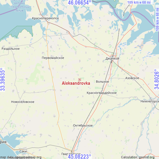
Aleksandrovka GPS coordinates[2]
45° 34' 35.544" North, 34° 5' 58.092" East
| Map corner | latitude | longitude |
|---|---|---|
| Upper-left | 46.06654°, | 33.39635° |
| Center: | 45.57654°, | 34.09947° |
| Lower-right: | 45.08223°, | 34.8026° |
| Map W x H: | 109.4×109.4 km | = 68×68mi |
| max Lat: | 52.18903° ⇑75.7% North |
| Aleksandrovka: | 45.57654° |
| min Lat: | ⇓24.3% South 44.39214° |
| min Long | Aleksandrovka | max Long |
| 22.20555° | 34.09947° | 40.13222° |
| W 65.4%⇐ | ⇒34.6% E |
Elevation
Elevation of Aleksandrovka is 32 m = 105 ft, and this is 123.8 m = 406 ft below average elevation for this country.
| Max E: |
886 m = 2907 ft | 84% |
| Avg. | 155.8 m = 511 ft | |
| Aleksandrovka | 32 m = 105 ft | |
Min E: |
-3 m = -10 ft | 16% |
See also: Ukraine elevation on elevation.city.
Geographical zone
Aleksandrovka is located in North temperate zone (between Tropic of Cancer and the Arctic Circle). Distance of this North polar circle is 2333.5 km =1450 mi to North.| Distance of | km | miles | from Aleksandrovka |
|---|---|---|---|
| North Pole | 4939.4 | 3069.2 | to North |
| Arctic Circle | 2333.5 | 1450 | to North |
| Tropic Cancer | 2461.7 | 1529.6 | to South |
| Equator | 5067.6 | 3148.9 | to South |


Nearby cities:
15 places around Aleksandrovka: (largest is in red/bold)
• Abrikosovo
12.9 km =8 mi,  0°
0°
• Chernovo
15 km =9.3 mi,  239°
239°
• Hvardiiske
9.6 km =6 mi,  276°
276°
• Kalinino
9.6 km =6 mi,  77°
77°
• Karpovka
6 km =3.7 mi,  194°
194°
• Klepinino
8.5 km =5.3 mi,  129°
129°
• Kommunary
10.1 km =6.3 mi,  108°
108°
• Krasnaya Polyana
11.6 km =7.2 mi,  168°
168°
• Kremnevka
12.1 km =7.5 mi, 185°
• Krymka
15.8 km =9.8 mi,  25°
25°
• Mirolyubovka
15.2 km =9.4 mi,  140°
140°
• Novoestoniya
14.1 km =8.8 mi, 127°
• Oktyabr’skoye
14.6 km =9.1 mi,  306°
306°
• Roskoshnoye
8.5 km =5.3 mi,  8°
8°
• Zernovoye
6.8 km =4.2 mi, 30°
Sources, notices
• [Note1] Compared only with cities in Ukraine existing in our database
• [Src1] Map data: © OpenStreetMap contributors (CC-BY-SA)
• [Src2] Other city data from geonames.org with taken over terms of usage.
• [Src3] Geographical zone / Annual Mean Temperature by Robert A. Rohde @ Wikipedia
