Entebbe geodata
Entebbe (Central Region) is a populated place; located in Uganda in Africa/Kampala (GMT+3) time zone. With population of 62,969 people, there are 10 cities with bigger population in this country. Compared to other cities in Uganda, 78.8% of cities are located further ↑North; 52.7% of cities are located further ←West and 58.9% of cities have higher elevation than Entebbe. Note1
Administrative division(s):
- Level 1: Central Region
- Level 2: Wakiso District
- Level 3: Entebbe Municipality
- Level 4: Division B


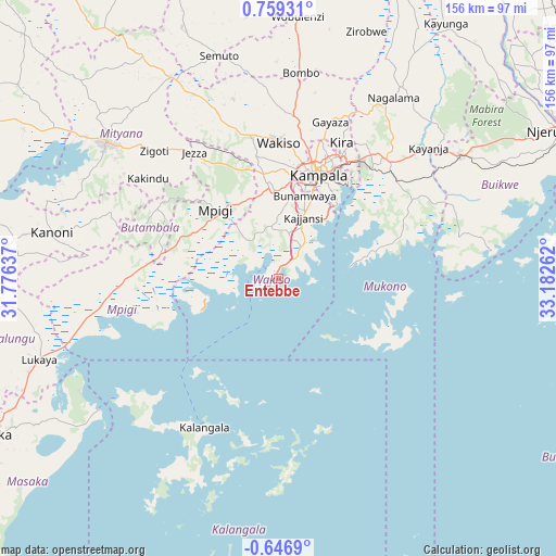
Entebbe GPS coordinates[2]
0° 3' 22.356" North, 32° 28' 46.164" East
| Map corner | latitude | longitude |
|---|---|---|
| Upper-left | 0.75931°, | 31.77637° |
| Center: | 0.05621°, | 32.47949° |
| Lower-right: | -0.6469°, | 33.18262° |
| Map W x H: | 156.4×156.4 km | = 97.2×97.2mi |
| max Lat: | 3.66088° ⇑78.8% North |
| Entebbe: | 0.05621° |
| min Lat: | ⇓21.2% South -1.28538° |
| min Long | Entebbe | max Long |
| 29.65° | 32.47949° | 34.95° |
| W 52.7%⇐ | ⇒47.3% E |
Elevation
Elevation of Entebbe is 1151 m = 3776 ft, and this is 108 m = 354 ft below average elevation for this country.
| Max E: |
4129 m = 13547 ft | 58.9% |
| Avg. | 1259 m = 4131 ft | |
| Entebbe | 1151 m = 3776 ft | |
Min E: |
622 m = 2041 ft | 41.1% |
See also: Entebbe elevation on elevation.city.
Geographical zone
Entebbe is located in North Torrid zone (between Equator and Tropic of Cancer). Distance of Equator is 6.2 km =3.9 mi to South.| Distance of | km | miles | from Entebbe |
|---|---|---|---|
| North Pole | 10000.8 | 6214.2 | to North |
| Arctic Circle | 7394.9 | 4595 | to North |
| Tropic Cancer | 2599.7 | 1615.4 | to North |
| Equator | 6.2 | 3.9 | to South |


Nearby cities:
15 places around Entebbe: (largest is in red/bold)
• Buikwe
66.8 km =41.5 mi,  62°
62°
• Bweyogerere
39.3 km =24.4 mi,  31°
31°
• Gombe
46.5 km =28.9 mi,  290°
290°
• Gombe
47.9 km =29.8 mi,  359°
359°
• Kajansi
18.7 km =11.6 mi,  19°
19°
• Kalangala
49.5 km =30.8 mi,  214°
214°
• Kampala
31.1 km =19.3 mi, 21°
• Kampala Central Division
31.7 km =19.7 mi, 19°
• Kireka
37.5 km =23.3 mi, 30°
• Lugazi
61.6 km =38.3 mi, 55°
• Lweeza
20.7 km =12.9 mi, 34°
• Mityana
64.7 km =40.2 mi,  308°
308°
• Mpigi
26.3 km =16.3 mi,  315°
315°
• Mukono
45.1 km =28 mi,  42°
42°
• Wakiso
38.8 km =24.1 mi, 356°
Sources, notices
• [Note1] Compared only with cities in Uganda existing in our database
• [Src1] Map data: © OpenStreetMap contributors (CC-BY-SA)
• [Src2] Other city data from geonames.org with taken over terms of usage.
• [Src3] Geographical zone / Annual Mean Temperature by Robert A. Rohde @ Wikipedia
