River Falls geodata
River Falls (Alabama) is a populated place; located in United States in America/Chicago (GMT-5) time zone. With population of 527 people, there are 20547 cities with bigger population in this country. Compared to other cities in United States, 90% of cities are located further ↑North; 51.4% of cities are located further ←West and 75.5% of cities have higher elevation than River Falls. Note1


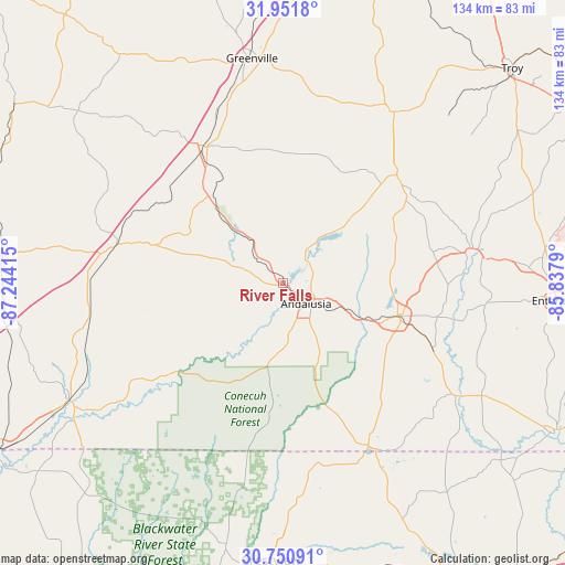
River Falls GPS coordinates[2]
31° 21' 11.772" North, 86° 32' 27.672" West
| Map corner | latitude | longitude |
|---|---|---|
| Upper-left | 31.9518°, | -87.24415° |
| Center: | 31.35327°, | -86.54102° |
| Lower-right: | 30.75091°, | -85.8379° |
| Map W x H: | 133.5×133.5 km | = 83×83mi |
| max Lat: | 71.29058° ⇑90% North |
| River Falls: | 31.35327° |
| min Lat: | ⇓10% South 19.06759° |
| min Long | River Falls | max Long |
| -171.73463° | -86.54102° | -66.98998° |
| W 51.4%⇐ | ⇒48.6% E |
Elevation
Elevation of River Falls is 69 m = 226 ft, and this is 225.8 m = 741 ft below average elevation for this country.
| Max E: |
3189 m = 10463 ft | 75.5% |
| Avg. | 294.8 m = 967 ft | |
| River Falls | 69 m = 226 ft | |
Min E: |
-60 m = -197 ft | 24.5% |
See also: United States elevation on elevation.city.
Geographical zone
River Falls is located in North temperate zone (between Tropic of Cancer and the Arctic Circle). Distance of this Northern Tropic circle is 880.2 km =546.9 mi to South.| Distance of | km | miles | from River Falls |
|---|---|---|---|
| North Pole | 6520.9 | 4051.9 | to North |
| Arctic Circle | 3915 | 2432.7 | to North |
| Tropic Cancer | 880.2 | 546.9 | to South |
| Equator | 3486.2 | 2166.2 | to South |


Nearby cities:
15 places around River Falls: (largest is in red/bold)
• Andalusia
7.5 km =4.7 mi,  132°
132°
• Babbie
22 km =13.7 mi,  111°
111°
• Brantley
37.1 km =23.1 mi,  46°
46°
• Castleberry
46.1 km =28.6 mi,  262°
262°
• Elba
45.4 km =28.2 mi,  81°
81°
• Evergreen
40.5 km =25.2 mi,  282°
282°
• Florala
43.7 km =27.2 mi,  152°
152°
• Georgiana
36.9 km =22.9 mi,  328°
328°
• Kinston
38.3 km =23.8 mi, 113°
• Laurel Hill
43.8 km =27.2 mi,  169°
169°
• Lockhart
42.2 km =26.2 mi, 154°
• Luverne
48.2 km =30 mi,  33°
33°
• McKenzie
26.7 km =16.6 mi,  321°
321°
• Opp
28.2 km =17.5 mi, 106°
• Paxton
46.9 km =29.1 mi, 151°
Sources, notices
• [Note1] Compared only with cities in United States existing in our database
• [Src1] Map data: © OpenStreetMap contributors (CC-BY-SA)
• [Src2] Other city data from geonames.org with taken over terms of usage.
• [Src3] Geographical zone / Annual Mean Temperature by Robert A. Rohde @ Wikipedia
