McKenzie geodata
McKenzie (Alabama) is a populated place; located in United States in America/Chicago (GMT-5) time zone. With population of 513 people, there are 20718 cities with bigger population in this country. Compared to other cities in United States, 89.5% of cities are located further ↑North; 51% of cities are located further ←West and 62.4% of cities have higher elevation than McKenzie. Note1


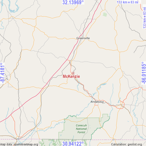
McKenzie GPS coordinates[2]
31° 32' 32.568" North, 86° 42' 53.892" West
| Map corner | latitude | longitude |
|---|---|---|
| Upper-left | 32.13969°, | -87.4181° |
| Center: | 31.54238°, | -86.71497° |
| Lower-right: | 30.94122°, | -86.01185° |
| Map W x H: | 133.3×133.3 km | = 82.8×82.8mi |
| max Lat: | 71.29058° ⇑89.5% North |
| McKenzie: | 31.54238° |
| min Lat: | ⇓10.5% South 19.06759° |
| min Long | McKenzie | max Long |
| -171.73463° | -86.71497° | -66.98998° |
| W 51%⇐ | ⇒49% E |
Elevation
Elevation of McKenzie is 142 m = 466 ft, and this is 152.8 m = 501 ft below average elevation for this country.
| Max E: |
3189 m = 10463 ft | 62.4% |
| Avg. | 294.8 m = 967 ft | |
| McKenzie | 142 m = 466 ft | |
Min E: |
-60 m = -197 ft | 37.6% |
See also: United States elevation on elevation.city.
Geographical zone
McKenzie is located in North temperate zone (between Tropic of Cancer and the Arctic Circle). Distance of this Northern Tropic circle is 901.3 km =560 mi to South.| Distance of | km | miles | from McKenzie |
|---|---|---|---|
| North Pole | 6499.9 | 4038.8 | to North |
| Arctic Circle | 3894 | 2419.6 | to North |
| Tropic Cancer | 901.3 | 560 | to South |
| Equator | 3507.2 | 2179.3 | to South |


Nearby cities:
15 places around McKenzie: (largest is in red/bold)
• Andalusia
34.1 km =21.2 mi,  139°
139°
• Babbie
47.1 km =29.3 mi,  128°
128°
• Brantley
43.6 km =27.1 mi,  84°
84°
• Brewton
59.3 km =36.8 mi,  214°
214°
• Castleberry
39.8 km =24.7 mi,  227°
227°
• East Brewton
59.9 km =37.2 mi, 213°
• Evergreen
25.9 km =16.1 mi,  242°
242°
• Fort Deposit
50.8 km =31.6 mi,  14°
14°
• Georgiana
10.8 km =6.7 mi,  346°
346°
• Greenville
33.2 km =20.6 mi,  16°
16°
• Joquin
58.8 km =36.5 mi,  62°
62°
• Luverne
46.9 km =29.1 mi,  65°
65°
• Monroeville
57.8 km =35.9 mi,  268°
268°
• Opp
52.3 km =32.5 mi,  123°
123°
• River Falls
26.7 km =16.6 mi, 141°
Sources, notices
• [Note1] Compared only with cities in United States existing in our database
• [Src1] Map data: © OpenStreetMap contributors (CC-BY-SA)
• [Src2] Other city data from geonames.org with taken over terms of usage.
• [Src3] Geographical zone / Annual Mean Temperature by Robert A. Rohde @ Wikipedia
