Thomaston geodata
Thomaston (Georgia) is a seat of a second-order administrative division; located in United States in America/New_York (GMT-4) time zone. With population of 9,032 people, there are 4795 cities with bigger population in this country. Compared to other cities in United States, 85.6% of cities are located further ↑North; 58.2% of cities are located further ←West and 58.6% of cities have lower elevation than Thomaston. Note1


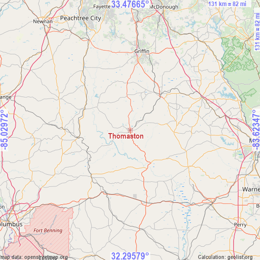
Thomaston GPS coordinates[2]
32° 53' 17.484" North, 84° 19' 35.724" West
| Map corner | latitude | longitude |
|---|---|---|
| Upper-left | 33.47665°, | -85.02972° |
| Center: | 32.88819°, | -84.32659° |
| Lower-right: | 32.29579°, | -83.62347° |
| Map W x H: | 131.3×131.3 km | = 81.6×81.6mi |
| max Lat: | 71.29058° ⇑85.6% North |
| Thomaston: | 32.88819° |
| min Lat: | ⇓14.4% South 19.06759° |
| min Long | Thomaston | max Long |
| -171.73463° | -84.32659° | -66.98998° |
| W 58.2%⇐ | ⇒41.8% E |
Elevation
Elevation of Thomaston is 233 m = 764 ft, and this is 61.8 m = 203 ft below average elevation for this country.
| Max E: |
3189 m = 10463 ft | 41.4% |
| Avg. | 294.8 m = 967 ft | |
| Thomaston | 233 m = 764 ft | |
Min E: |
-60 m = -197 ft | 58.6% |
See also: United States elevation on elevation.city.
Geographical zone
Thomaston is located in North temperate zone (between Tropic of Cancer and the Arctic Circle). Distance of this Northern Tropic circle is 1050.9 km =653 mi to South.| Distance of | km | miles | from Thomaston |
|---|---|---|---|
| North Pole | 6350.2 | 3945.8 | to North |
| Arctic Circle | 3744.4 | 2326.7 | to North |
| Tropic Cancer | 1050.9 | 653 | to South |
| Equator | 3656.8 | 2272.2 | to South |


Nearby cities:
15 places around Thomaston: (largest is in red/bold)
• Barnesville
24.4 km =15.2 mi,  40°
40°
• Butler
37.7 km =23.4 mi,  167°
167°
• Forsyth
39.7 km =24.7 mi,  65°
65°
• Greenville
39.3 km =24.4 mi,  293°
293°
• Hannahs Mill
5.4 km =3.4 mi,  336°
336°
• Knoxville
35.7 km =22.2 mi,  120°
120°
• Lincoln Park
2.3 km =1.4 mi,  189°
189°
• Manchester
27.6 km =17.1 mi,  263°
263°
• Milner
28.2 km =17.5 mi,  25°
25°
• Roberta
34.6 km =21.5 mi, 122°
• Sardis
30.9 km =19.2 mi,  250°
250°
• Sunset Village
7.3 km =4.5 mi,  278°
278°
• Talbotton
30.7 km =19.1 mi,  220°
220°
• Woodbury
26.2 km =16.3 mi, 293°
• Zebulon
23.9 km =14.9 mi,  356°
356°
Sources, notices
• [Note1] Compared only with cities in United States existing in our database
• [Src1] Map data: © OpenStreetMap contributors (CC-BY-SA)
• [Src2] Other city data from geonames.org with taken over terms of usage.
• [Src3] Geographical zone / Annual Mean Temperature by Robert A. Rohde @ Wikipedia
