Manhattan geodata
Manhattan (Kansas) is a seat of a second-order administrative division; located in United States in America/Chicago (GMT-5) time zone. With population of 56,308 people, there are 810 cities with bigger population in this country. Compared to other cities in United States, 53.2% of cities are located further ↑North; 74.6% of cities are located further →East and 75.3% of cities have lower elevation than Manhattan. Note1


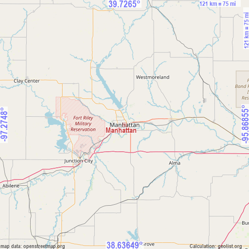
Manhattan GPS coordinates[2]
39° 11' 0.996" North, 96° 34' 18.012" West
| Map corner | latitude | longitude |
|---|---|---|
| Upper-left | 39.7265°, | -97.2748° |
| Center: | 39.18361°, | -96.57167° |
| Lower-right: | 38.63649°, | -95.86855° |
| Map W x H: | 121.2×121.2 km | = 75.3×75.3mi |
| max Lat: | 71.29058° ⇑53.2% North |
| Manhattan: | 39.18361° |
| min Lat: | ⇓46.8% South 19.06759° |
| min Long | Manhattan | max Long |
| -171.73463° | -96.57167° | -66.98998° |
| W 25.4%⇐ | ⇒74.6% E |
Elevation
Elevation of Manhattan is 315 m = 1033 ft, and this is 20.2 m = 66 ft above average elevation for this country.
| Max E: |
3189 m = 10463 ft | 24.7% |
| Manhattan | 315 m 1033 ft | |
| Avg. | 294.8 m = 967 ft | |
Min E: |
-60 m = -197 ft | 75.3% |
See also: Manhattan elevation on elevation.city.
Geographical zone
Manhattan is located in North temperate zone (between Tropic of Cancer and the Arctic Circle). Distance of this Northern Tropic circle is 1750.9 km =1088 mi to South.| Distance of | km | miles | from Manhattan |
|---|---|---|---|
| North Pole | 5650.3 | 3510.9 | to North |
| Arctic Circle | 3044.4 | 1891.7 | to North |
| Tropic Cancer | 1750.9 | 1088 | to South |
| Equator | 4356.8 | 2707.2 | to South |


Nearby cities:
15 places around Manhattan: (largest is in red/bold)
• Alma
30.6 km =19 mi,  127°
127°
• Chapman
45.5 km =28.3 mi,  238°
238°
• Fort Riley North
22.4 km =13.9 mi,  248°
248°
• Grandview Plaza
25.4 km =15.8 mi,  227°
227°
• Junction City
28.3 km =17.6 mi, 232°
• Maple Hill
48.2 km =30 mi,  103°
103°
• Milford
29.4 km =18.3 mi,  266°
266°
• Ogden
14.1 km =8.8 mi, 235°
• Riley
25.7 km =16 mi,  299°
299°
• Saint George
13.1 km =8.1 mi,  86°
86°
• Saint Marys
43.2 km =26.8 mi, 88°
• Wakefield
37.5 km =23.3 mi,  275°
275°
• Wamego
23.1 km =14.4 mi,  84°
84°
• Westmoreland
27 km =16.8 mi,  30°
30°
• White City
45.4 km =28.2 mi,  198°
198°
Sources, notices
• [Note1] Compared only with cities in United States existing in our database
• [Src1] Map data: © OpenStreetMap contributors (CC-BY-SA)
• [Src2] Other city data from geonames.org with taken over terms of usage.
• [Src3] Geographical zone / Annual Mean Temperature by Robert A. Rohde @ Wikipedia
