Chapman geodata
Chapman (Kansas) is a populated place; located in United States in America/Chicago (GMT-5) time zone. With population of 1,376 people, there are 14230 cities with bigger population in this country. Compared to other cities in United States, 55.2% of cities are located further ↑North; 75.8% of cities are located further →East and 79% of cities have lower elevation than Chapman. Note1


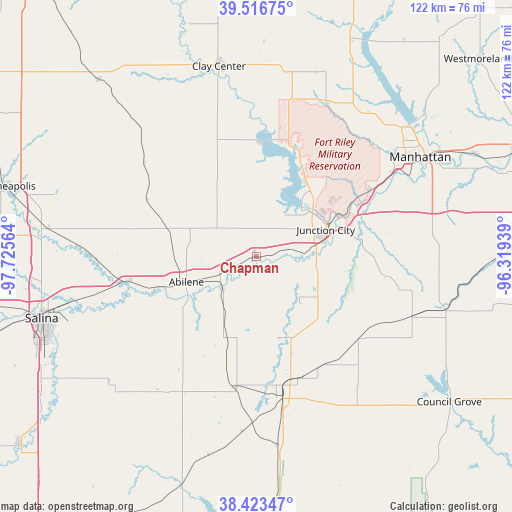
Chapman GPS coordinates[2]
38° 58' 19.992" North, 97° 1' 21.036" West
| Map corner | latitude | longitude |
|---|---|---|
| Upper-left | 39.51675°, | -97.72564° |
| Center: | 38.97222°, | -97.02251° |
| Lower-right: | 38.42347°, | -96.31939° |
| Map W x H: | 121.6×121.6 km | = 75.6×75.6mi |
| max Lat: | 71.29058° ⇑55.2% North |
| Chapman: | 38.97222° |
| min Lat: | ⇓44.8% South 19.06759° |
| min Long | Chapman | max Long |
| -171.73463° | -97.02251° | -66.98998° |
| W 24.2%⇐ | ⇒75.8% E |
Elevation
Elevation of Chapman is 344 m = 1129 ft, and this is 49.2 m = 161 ft above average elevation for this country.
| Max E: |
3189 m = 10463 ft | 21% |
| Chapman | 344 m 1129 ft | |
| Avg. | 294.8 m = 967 ft | |
Min E: |
-60 m = -197 ft | 79% |
See also: United States elevation on elevation.city.
Geographical zone
Chapman is located in North temperate zone (between Tropic of Cancer and the Arctic Circle). Distance of this Northern Tropic circle is 1727.4 km =1073.4 mi to South.| Distance of | km | miles | from Chapman |
|---|---|---|---|
| North Pole | 5673.8 | 3525.5 | to North |
| Arctic Circle | 3067.9 | 1906.3 | to North |
| Tropic Cancer | 1727.4 | 1073.4 | to South |
| Equator | 4333.3 | 2692.6 | to South |


Nearby cities:
15 places around Chapman: (largest is in red/bold)
• Abilene
17.6 km =10.9 mi,  249°
249°
• Bennington
49.8 km =30.9 mi,  277°
277°
• Clay Center
45.9 km =28.5 mi,  348°
348°
• Enterprise
11.2 km =7 mi,  226°
226°
• Fort Riley North
23.7 km =14.7 mi,  49°
49°
• Grandview Plaza
21.1 km =13.1 mi,  72°
72°
• Herington
34.2 km =21.3 mi,  168°
168°
• Junction City
17.7 km =11 mi, 69°
• Manhattan
45.5 km =28.3 mi,  58°
58°
• Milford
23.8 km =14.8 mi,  23°
23°
• Ogden
31.4 km =19.5 mi, 60°
• Riley
39.9 km =24.8 mi, 24°
• Solomon
30.7 km =19.1 mi,  258°
258°
• Wakefield
26.8 km =16.7 mi,  3°
3°
• White City
31.6 km =19.6 mi,  128°
128°
Sources, notices
• [Note1] Compared only with cities in United States existing in our database
• [Src1] Map data: © OpenStreetMap contributors (CC-BY-SA)
• [Src2] Other city data from geonames.org with taken over terms of usage.
• [Src3] Geographical zone / Annual Mean Temperature by Robert A. Rohde @ Wikipedia
