Arkansas City geodata
Arkansas City (Kansas) is a populated place; located in United States in America/Chicago (GMT-5) time zone. With population of 12,136 people, there are 3862 cities with bigger population in this country. Compared to other cities in United States, 65.9% of cities are located further ↑North; 75.8% of cities are located further →East and 79.1% of cities have lower elevation than Arkansas City. Note1


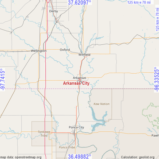
Arkansas City GPS coordinates[2]
37° 3' 43.092" North, 97° 2' 18.132" West
| Map corner | latitude | longitude |
|---|---|---|
| Upper-left | 37.62097°, | -97.7415° |
| Center: | 37.06197°, | -97.03837° |
| Lower-right: | 36.49882°, | -96.33525° |
| Map W x H: | 124.8×124.8 km | = 77.5×77.5mi |
| max Lat: | 71.29058° ⇑65.9% North |
| Arkansas City: | 37.06197° |
| min Lat: | ⇓34.1% South 19.06759° |
| min Long | Arkansas City | max Long |
| -171.73463° | -97.03837° | -66.98998° |
| W 24.2%⇐ | ⇒75.8% E |
Elevation
Elevation of Arkansas City is 345 m = 1132 ft, and this is 50.2 m = 165 ft above average elevation for this country.
| Max E: |
3189 m = 10463 ft | 20.9% |
| Arkansas City | 345 m 1132 ft | |
| Avg. | 294.8 m = 967 ft | |
Min E: |
-60 m = -197 ft | 79.1% |
See also: United States elevation on elevation.city.
Geographical zone
Arkansas City is located in North temperate zone (between Tropic of Cancer and the Arctic Circle). Distance of this Northern Tropic circle is 1515 km =941.4 mi to South.| Distance of | km | miles | from Arkansas City |
|---|---|---|---|
| North Pole | 5886.2 | 3657.5 | to North |
| Arctic Circle | 3280.3 | 2038.3 | to North |
| Tropic Cancer | 1515 | 941.4 | to South |
| Equator | 4120.9 | 2560.6 | to South |


Nearby cities:
15 places around Arkansas City: (largest is in red/bold)
• Belle Plaine
42.7 km =26.5 mi,  329°
329°
• Blackwell
35.9 km =22.3 mi,  217°
217°
• Burden
37.6 km =23.4 mi,  42°
42°
• Caldwell
50.6 km =31.4 mi,  266°
266°
• Cedar Vale
48 km =29.8 mi,  84°
84°
• Douglass
50.9 km =31.6 mi,  2°
2°
• McCord
42.6 km =26.5 mi,  180°
180°
• Mulvane
49.3 km =30.6 mi,  338°
338°
• Newkirk
20 km =12.4 mi, 183°
• Oxford
26.3 km =16.3 mi, 333°
• Ponca City
39.7 km =24.7 mi,  186°
186°
• Tonkawa
49 km =30.4 mi,  209°
209°
• Udall
36.8 km =22.9 mi,  349°
349°
• Wellington
37.2 km =23.1 mi,  307°
307°
• Winfield
20.1 km =12.5 mi,  10°
10°
Sources, notices
• [Note1] Compared only with cities in United States existing in our database
• [Src1] Map data: © OpenStreetMap contributors (CC-BY-SA)
• [Src2] Other city data from geonames.org with taken over terms of usage.
• [Src3] Geographical zone / Annual Mean Temperature by Robert A. Rohde @ Wikipedia
