Mount Vernon geodata
Mount Vernon (Kentucky) is a populated place; located in United States in America/New_York (GMT-4) time zone. With population of 2,583 people, there are 10430 cities with bigger population in this country. Compared to other cities in United States, 61.4% of cities are located further ↑North; 57.4% of cities are located further ←West and 74.4% of cities have lower elevation than Mount Vernon. Note1


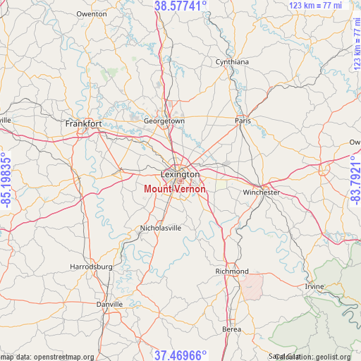
Mount Vernon GPS coordinates[2]
38° 1' 32.268" North, 84° 29' 42.792" West
| Map corner | latitude | longitude |
|---|---|---|
| Upper-left | 38.57741°, | -85.19835° |
| Center: | 38.02563°, | -84.49522° |
| Lower-right: | 37.46966°, | -83.7921° |
| Map W x H: | 123.2×123.2 km | = 76.6×76.6mi |
| max Lat: | 71.29058° ⇑61.4% North |
| Mount Vernon: | 38.02563° |
| min Lat: | ⇓38.6% South 19.06759° |
| min Long | Mount Vernon | max Long |
| -171.73463° | -84.49522° | -66.98998° |
| W 57.4%⇐ | ⇒42.6% E |
Elevation
Elevation of Mount Vernon is 309 m = 1014 ft, and this is 14.2 m = 47 ft above average elevation for this country.
| Max E: |
3189 m = 10463 ft | 25.6% |
| Mount Vernon | 309 m 1014 ft | |
| Avg. | 294.8 m = 967 ft | |
Min E: |
-60 m = -197 ft | 74.4% |
See also: United States elevation on elevation.city.
Geographical zone
Mount Vernon is located in North temperate zone (between Tropic of Cancer and the Arctic Circle). Distance of this Northern Tropic circle is 1622.1 km =1007.9 mi to South.| Distance of | km | miles | from Mount Vernon |
|---|---|---|---|
| North Pole | 5779 | 3590.9 | to North |
| Arctic Circle | 3173.1 | 1971.7 | to North |
| Tropic Cancer | 1622.1 | 1007.9 | to South |
| Equator | 4228.1 | 2627.2 | to South |


Nearby cities:
15 places around Mount Vernon: (largest is in red/bold)
• Frankfort
38.4 km =23.9 mi,  300°
300°
• Georgetown
21.2 km =13.2 mi,  344°
344°
• Lawrenceburg
35.2 km =21.9 mi,  272°
272°
• Lexington
4.4 km =2.7 mi,  159°
159°
• Lexington-Fayette
4.2 km =2.6 mi,  50°
50°
• Midway
21.6 km =13.4 mi,  310°
310°
• Monticello
6.1 km =3.8 mi,  232°
232°
• Nicholasville
17.5 km =10.9 mi,  202°
202°
• North Middletown
36.1 km =22.4 mi,  68°
68°
• Paris
29.5 km =18.3 mi, 45°
• Richmond
35.5 km =22.1 mi,  150°
150°
• Stamping Ground
32.1 km =19.9 mi,  328°
328°
• Versailles
20.8 km =12.9 mi,  278°
278°
• Wilmore
23.3 km =14.5 mi,  218°
218°
• Winchester
27.9 km =17.3 mi,  98°
98°
Sources, notices
• [Note1] Compared only with cities in United States existing in our database
• [Src1] Map data: © OpenStreetMap contributors (CC-BY-SA)
• [Src2] Other city data from geonames.org with taken over terms of usage.
• [Src3] Geographical zone / Annual Mean Temperature by Robert A. Rohde @ Wikipedia
