Frankfort geodata
Frankfort (Kentucky) is a seat of a first-order administrative division; located in United States in America/New_York (GMT-4) time zone. With population of 27,830 people, there are 1802 cities with bigger population in this country. Compared to other cities in United States, 60.6% of cities are located further ↑North; 56.2% of cities are located further ←West and 60.1% of cities have higher elevation than Frankfort. Note1


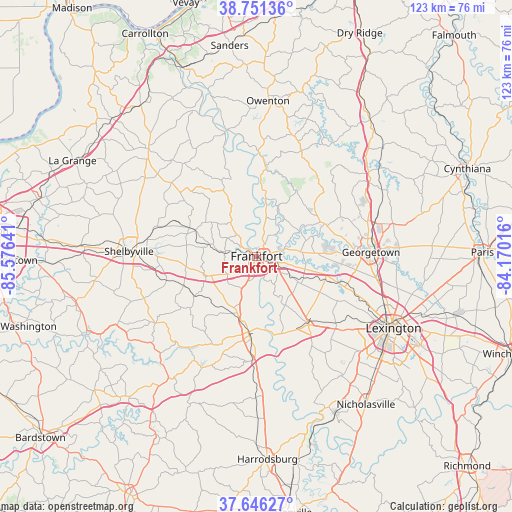
Frankfort GPS coordinates[2]
38° 12' 3.276" North, 84° 52' 23.808" West
| Map corner | latitude | longitude |
|---|---|---|
| Upper-left | 38.75136°, | -85.57641° |
| Center: | 38.20091°, | -84.87328° |
| Lower-right: | 37.64627°, | -84.17016° |
| Map W x H: | 122.9×122.9 km | = 76.4×76.4mi |
| max Lat: | 71.29058° ⇑60.6% North |
| Frankfort: | 38.20091° |
| min Lat: | ⇓39.4% South 19.06759° |
| min Long | Frankfort | max Long |
| -171.73463° | -84.87328° | -66.98998° |
| W 56.2%⇐ | ⇒43.8% E |
Elevation
Elevation of Frankfort is 154 m = 505 ft, and this is 140.8 m = 462 ft below average elevation for this country.
| Max E: |
3189 m = 10463 ft | 60.1% |
| Avg. | 294.8 m = 967 ft | |
| Frankfort | 154 m = 505 ft | |
Min E: |
-60 m = -197 ft | 39.9% |
See also: United States elevation on elevation.city.
Geographical zone
Frankfort is located in North temperate zone (between Tropic of Cancer and the Arctic Circle). Distance of this Northern Tropic circle is 1641.6 km =1020 mi to South.| Distance of | km | miles | from Frankfort |
|---|---|---|---|
| North Pole | 5759.5 | 3578.8 | to North |
| Arctic Circle | 3153.6 | 1959.6 | to North |
| Tropic Cancer | 1641.6 | 1020 | to South |
| Equator | 4247.5 | 2639.3 | to South |


Nearby cities:
15 places around Frankfort: (largest is in red/bold)
• Eminence
32.8 km =20.4 mi,  305°
305°
• Georgetown
27.5 km =17.1 mi,  87°
87°
• Jackson
41.8 km =26 mi,  179°
179°
• Lawrenceburg
18.3 km =11.4 mi,  186°
186°
• Lexington
41.9 km =26 mi,  124°
124°
• Lexington-Fayette
40 km =24.9 mi,  114°
114°
• Midway
17.5 km =10.9 mi, 108°
• Monticello
36.6 km =22.7 mi,  129°
129°
• Mount Vernon
38.4 km =23.9 mi, 120°
• New Castle
36.6 km =22.7 mi, 314°
• Owenton
37.4 km =23.2 mi,  3°
3°
• Pleasureville
26.6 km =16.5 mi, 307°
• Shelbyville
30.6 km =19 mi,  272°
272°
• Stamping Ground
18.1 km =11.2 mi,  64°
64°
• Versailles
20.7 km =12.9 mi,  142°
142°
Sources, notices
• [Note1] Compared only with cities in United States existing in our database
• [Src1] Map data: © OpenStreetMap contributors (CC-BY-SA)
• [Src2] Other city data from geonames.org with taken over terms of usage.
• [Src3] Geographical zone / Annual Mean Temperature by Robert A. Rohde @ Wikipedia
